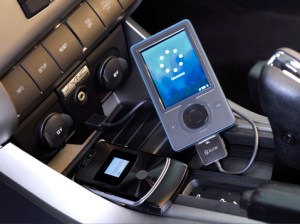
Automaker Ford has been hyping up its Microsoft-based Sync technology, which enables users to manage their music, makes hands-free calls, get news and information, and (of course) hear turn-by-turn directions using a cloud-based Internet services. Now, Ford is finally letting Sync step a little outside the Microsoft ecosystem: starting next month, folks with Sync-enabled vehicles will be able to pick destinations using Google Maps and send them to their Sync-enabled vehicles. Users find their destination using Google Maps—using a PC, smartphone, or other device—then send the destination to their Ford vehicles through the cloud-based Sync Traffic, Directions, and Information (TDI) application.
“Printing paper directions from a Web site is a relic in our digital age,” said Ford Connected Services Solutions director Doug VanDagens, in a statement. “With Send to Sync, you can map a destination at home, at work—wherever you have connectivity—and when you get to your car, it already knows where you want to go. It’s convenient and it eliminates the waste and distraction of paper maps, conserving resources while helping drivers keep their eyes on the road.”
Users will also be able to download destination information into the vehicle from Bluetooth enabled phones and devices: the Sync system will offer turn-by-turn directions to the destination.
The Google Maps capability will be available via a “Send” option on the Google Maps site. Once in the Sync-equipped Ford, Lincoln, or Mercury vehicle, users just need to connect to the Sync TDI application and confirm the request to download Google Maps destinations. The system then does its own route planning.
The Google Maps integration should launch later this month for Sync-equipped 2010-2011 Ford, Lincoln, and Mercury vehicles. Ford previously announced it plans to bring similar functionality to MapQuest later this year.
Editors' Recommendations
- Google is bringing Chrome browser to cars, even more EV features to Maps
- Sustainable with Google 2021: Nest Renew, traffic light efficiency, and more
- How Google Maps put turn-by-turn navigation in your pocket
- Ford vehicles will get over-the-air software updates beginning in 2020
- Ford Sync 4 lets Apple CarPlay and Android Auto users cut the cord


