
The Albertan government is working with Edmonton-based Elevated Robotic Services, which also uses its air-based technology in projects involving mining, insurance, and construction companies.
The use of remotely controlled flying machines in the Canadian disaster highlight how governments and businesses are becoming increasingly interested in the technology, adding weight to forecasts suggesting the drone market will flourish in the coming years once regulations for the commercial operation of the devices begin to be relaxed.
Elevated’s DJI-made quadcopters are using regular HD cameras alongside infrared and ultraviolet ones to gather data that could help experts discover the source of the ongoing wildfire. Hundreds of images shot by the cameras will be stitched together as part of a so-called “fire mapping” process.
“It’s like Google Maps but 100 times better,” Mat Matthews, Elevated’s safety manager, told Reuters.
The stitched imagery has the potential to place the location of a fire’s origin to within 9-meters, a far smaller area than can be achieved using helicopters, which have to stay at a much higher altitude not only for safety reasons but also to prevent the blades from fanning the flames and disturbing the location further.
Once the fire maps have been examined and the area is deemed safe to enter, investigators will explore the scene on the ground in a bid to find out exactly how the blaze started.
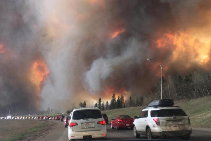
The advance of the Alberta blaze, which over the last week has forced all 80,000 residents of Fort McMurray to flee, is thought to be slowing, though the authorities admit it could be “months” before all the flames are finally extinguished.
The last time we heard about drones and wildfires, they were hindering rather than helping the situation. Emergency workers tackling blazes last year in San Bernardino County, California, were forced to suspend air operations after a number of hobby drones were seen flying in the area, their owners likely hoping to score some dramatic footage of the fire. Hopefully those dealing with the Alberta disaster aren’t having to contend with similar interference from hobbyists; Elevated’s drone pilots, meanwhile, will be working closely with the authorities to ensure its machines stay well clear of planes and helicopters tackling the fire.
Editors' Recommendations
- It’s drone delivery, but not as we know it
- It’s part drone, part plane, and headed to the skies in 2025
- Watch this pest controller use a drone to vacuum up a wasp nest
- New drone owner? Check out this video before you fly
- Drone-delivery specialist Wing lifts the lid on its secret testing facility


