
You’re out on your first jog in more than a week. You’ve been running for maybe a half hour when you’re suddenly overcome by a shortness of breath. Your chest feels strangely tight, and as you breath you emit an odd rasping, wheezing noise. Is it your fitness level that’s faltering, you wonder, or could there be some external reason your body is responding like this.
You pull up Google Maps on your smartwatch. Along with a dot showing your present location, there’s also some contextual information about your surroundings, revealing that you’ve run into a section of town where air pollution levels are excessively high. Another app, drawing on this information and your own health data, suggests that the air quality levels might be triggering your asthma. With a couple of taps of the wrist, you reconfigure Google Maps and plot a route that will take you home via some parks where clean air is in ready supply.
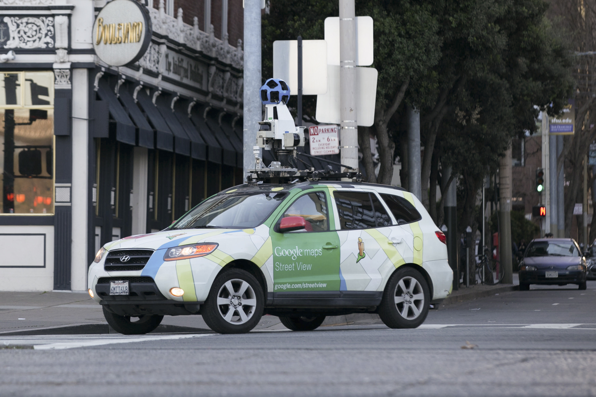
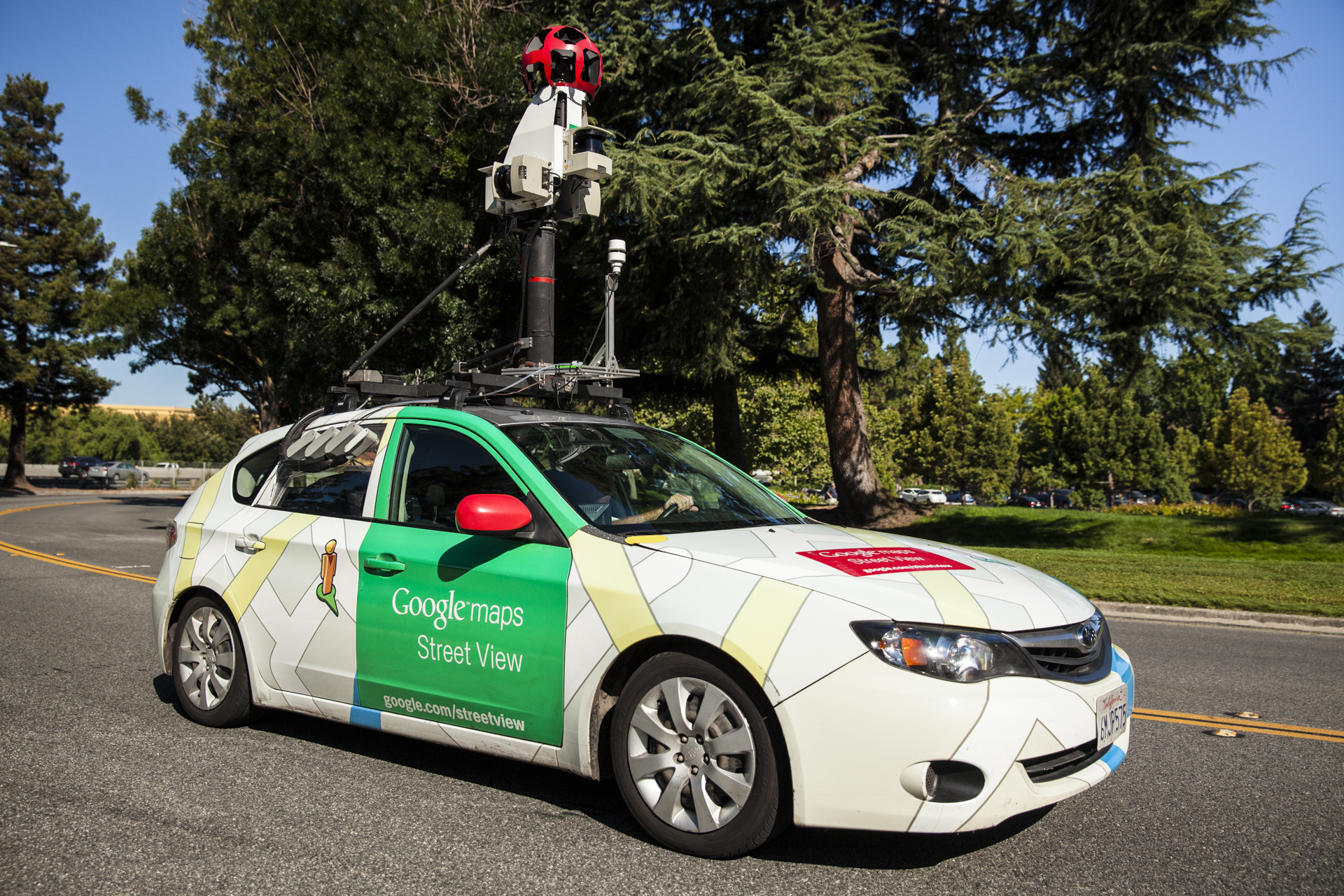
No, the above scenario isn’t currently possible, but it very well soon could be. For the past several years, a growing number of Google’s Street View cars have been doing more than just taking photos. They’ve also been measuring air quality. In the process, Google has been building a map of air quality not just in different cities, or different neighborhoods, but on the “hyper-local” level of individual blocks or streets. Now it’s taking those efforts to the next level.

This is far more fine-grained data than the current fixed air quality monitoring stations dotted throughout each city. In New York City, for instance, there are just 17 monitoring stations for a city stretching 300 square miles. That may be useful data, but it is woefully inadequate when you consider that air pollution levels can vary drastically within a single block. With air pollution responsible for killing an estimated 55,000 people per year in the U.S. alone, and 3.3 million people globally, a better solution is needed.
The world’s biggest search company thinks that it can help.
In the beginning
Several years after Street View went live, Google was approached by a nonprofit group called the Environmental Defense Fund. The group had an idea: What if Google was to use its Street View cars, with their 360-degree sensing technology and high-precision GPS, to not just gather data about the visible world, but also the invisible world? More specifically, what if the search giant agreed to kit out its cars with air quality sensors to record this information wherever it drove? The EDF had developed a proof-of-concept showing how this could work, but it had nowhere near the resources to scale such a solution.
“We’ve gone very slowly, because air quality measurement is a difficult field. We wanted to make sure we were doing it right.”
The idea found its way onto the desk of Karin Tuxen-Bettman, program manager for a division of Google called Google Earth Outreach. Tuxen-Bettman was intrigued. She sought out help from a company called Aclima, which develops scientific sensors and a sensor-based air quality mapping platform. Then she agreed to carry out a localized test study in the city of Oakland, roughly an hour’s drive from Google’s Mountain View headquarters.
“For a whole year we drove [our Street Views cars there],” Tuxen-Bettman told Digital Trends. “We actually over-drove because we wanted to work out how much driving was necessary and whether our algorithms were robust.” It turned out that they were.
The test drive also allowed Aclima to test out its equipment over a long period of time. “[They] had to add temperature control mechanisms inside their mobile sensing nodes to make sure that the humidity and temperature control inside the box was regulated,” Tuxen-Bettman continued. “We knew how these sensors performed after one month on the road, but what about six months? We didn’t want to have to bring these cars back every night or every week.”
Since then, Google’s Project Air View — as it became known — expanded. First it set its sights on the rest of California. Now it’s moved overseas, covering cities like London in the U.K. and Copenhagen in the Netherlands. “We’ve gone very slowly, because air quality measurement is a difficult field,” Tuxen-Bettman said. “We wanted to make sure we were doing it right.”
Wherever they go, the company’s sensor-equipped cars take multiple readings of the air quality in each location. Air samples are gathered via an intake tube on the vehicles’ front bumper, which filters through to an analysis unit in the trunk. This data is then sent to the Google Cloud where it analyzed and integrated into an increasingly giant and detailed map.
Google likes big challenges
“I think Google really likes these big challenges,” Tuxen-Bettman said. “Air quality is a huge challenge, and it’s one that’s not going away for quite some time.”
Project Air View fits into Google’s overall mission statement in a couple of ways. The first, the geeky engineering explanation, is that it’s part of Google’s dream of helping “organize the world’s information and [making] it universally accessible.”
“It can be hard for cities to really zero-in on what the source of the problems are.”
Like latter day Francis Galtons (minus the problematic interest in eugenics), Google wants to measure, sort, and filter. Galton created air-pressure maps and beauty maps. He set out to establish objective measures of boredom and the efficacy of prayer. Google, for its part, wants to use geolocation to create a personal record of everywhere users have ever been. It wants to create order out of the chaos of unstructured web pages and images. And it wants to build the most complex, accurate map ever created in human history — and why wouldn’t air quality be a part of that?
One day, although not yet, the hope is that Project Air View data will be baked into Google’s various software offerings. “It’s not incorporated into our products yet, but we hope that in the future people will be able to go to Google Maps and Google Earth and see the finished product,” Tuxen-Bettman said.
Just as exciting is the possibility of other apps drawing on this data, correlating it with user health metrics, to make interesting (and potentially life-changing) connections. “We are not creating wearable sensors, but there are companies out there which are creating them,” Tuxen-Bettman said. “You could envision them using data like this, and other data, to do [interesting things.]”
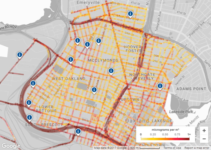
The potential of this has already been highlighted in a study involving Google’s air quality data from Oakland. Published in the journal Environmental Health, the study combined the street-level data with six years of electronic health records from more than 40,000 local residents. It concluded that those who lived in areas with higher levels of air pollution were significantly more likely to suffer from heart disease. Going forward, it is possible to imagine similar correlations and recommendations being made for both communities and individuals.
“What we want to make it easy to do is to combine this data, take it out and [let people insert it into other] systems to really understand the health impacts,” Tuxen-Bettman said.
Measuring air quality, saving the planet?
But the project also fits into Google’s focus on sustainability. This is something Google has long engaged with as a company. After all, the scenario painted at the front of this article could certainly serve as an individual solution, but it addresses a symptom; not the problem of pollution itself. It would be like utilizing a machine learning algorithm which predicts crime levels in an area based on Street View images, and using this to plan a drive home that minimizes your chances of being the victim of a carjacking.
Fifty more Street View cars will debut this summer allowing Google to expand the initiative to more cities than ever.
Yes, it’s good for you, but it doesn’t address the wider issue. In fact, it could exacerbate problems, since areas would not only remain crime-riddled, but they could be algorithmically scrubbed from existence for those who don’t have to live there. The same is equally true of awareness of air pollution.
However, Google hopes that Project Air View will have much broader implications. It could be used to inform policy by giving lawmakers more granular data to make decisions.
“There are pockets of every city that struggle more than other neighborhoods,” Tuxen-Bettman said. “There are lots of different reasons for that. It can be hard for cities to really zero-in on what the source of the problems are: which neighborhoods are affected the most; how to target policies towards certain geographic regions. This is becoming more and more important as we see cities like London putting in low emission vehicle zones. They need to know where these should be, where the biggest air pollution problems are.”
The Ultra Low Emission Zone scheme being introduced in London aims at improving air quality. Individuals who drive polluting vehicles into the city center will face a daily charge for doing so. To help quantify improvements, Google has used its Street View vehicles to gather air quality information both before and, going forward, after the introduction of these zones. Such analysis will make it possible to analyze how similar policies can make a difference; not just in the macro sense, but also on a block-by-block basis.
What to expect next
As with Google Street View, users shouldn’t expect real-time measurements, though. After all, there’s only so many times that Google’s fleet of cars can drive up and down a street collecting data. “Real-time data requires a lot of signals,” Tuxen-Bettman said. “We haven’t looked at what would be needed for that, to get real-time data at the highest spatial resolution.”
But this doesn’t mean that this cannot change over time. Doing so will require much more than just Google’s involvement, however. Tuxen-Bettman suggested that Google’s data could be used in conjunction with data gathered from a number of other sources. For example, in 2018 the European Space Agency launched the Copernicus Sentinel-5P satellite, tasked with mapping air pollutants around the globe on a daily basis. “You could envision our data being combined with their data — and that’s something that scientists are already doing,” she said.
In the meantime, Google continues to expand Project Air View. Fifty more Street View cars will be kitted out with Aclima’s air quality mapping platform this summer (“We’re finalizing our list in the next month or so,” she said), and this should allow Google to expand the initiative to more cities than ever. It could also inspire other non-Google fleets of vehicles around the world to consider adopting the tech.
“We hope that we’re not the only ones in the future doing this. There are lots of different fleets: delivery fleets, waste management fleets,” Tuxen-Bettman said. “We’re hoping that all of these fleets which are already out there doing their daily jobs could be used as runoff platforms. All this information could then be shared.”
It’s not too often that tech giants actively hope that others will copy them. But when it comes to changing the world for the better, we guess that’s a good enough reason.
Editors' Recommendations
- Are you immortalized on Google Street View? It’s easy to find out
- Google Maps’ latest features aim to ease holiday season stress
- Google reveals how many miles its Street View cars have driven to date
- Apple Maps adds Street View-style imagery, but with a neat trick