
Google’s SOS Alerts feature brings real-time crisis info to Maps and Search

google maps
Image used with permission by copyright holder
Whether it’s in the aftermath of a natural disaster or a terrorist attack, actionable, up-to-the-minute information about the situation on the ground is key. That’s the idea behind SOS Alerts, a new feature in the Google Maps and Google Search apps that prominently highlights top stories, websites, and other useful information.

In Google’s Search app for iOS and Android, SOS Alerts will appear at the top of search results for the incident or location. Swiping up on the tab will show such information as emergency phone numbers, websites, and translations of useful phrases, plus related maps and top stories. You’ll see official alerts and tweets from first responders, too, and in some cases a timeline-like overview of the situation and donation opportunities.

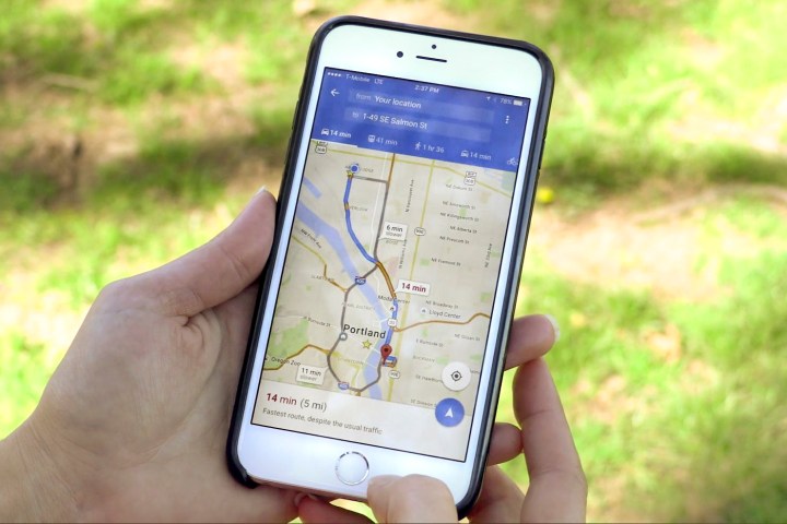
SOS Alerts aren’t just limited to Google Search. They’ll appear in Google Maps, too, where you’ll see real-time updates on road closures, traffic slowdowns, and transit problems. A tappable icon on the map with more information will appear near the location of the crisis, along with a card containing helpful phone numbers, websites, and other info.

In some cases, Google will be a little more proactive. If you’re in or close to an affected area, you’ll get a notification on your smartphone that will direct you to the aforementioned news, maps, and resources.

Google isn’t rolling out SOS Alerts as a half-baked feature. The company says it has worked closely with organizations and government agencies “on the front lines of relief efforts,” including the Red Cross and the Federal Emergency Management Agency in the U.S., and agencies in other countries such as the Philippine Atmospheric Geophysical and Astronomical Services Administration, to supply SOS Alerts with real-time information.

Initially, SOS Alerts will be available in 12 locations, including the U.S., Canada, Australia, Japan, India, and Brazil. Google says a lack of local partners hindered the feature’s launch in the U.K. and other parts of Europe, but that it’s working to recruit more agencies and nonprofits in the coming months.

SOS Alerts may be Google’s latest crisis-monitoring efforts, but it’s not the only one.

Google used its Person Finder tool to help people check the status of loved ones in the aftermath of the 2011 earthquakes and tsunami in Japan. And it has deployed Crises Maps — toggleable Google Maps layers that highlight dangerous areas and emergency services — during Hurricane Sandy and other natural disasters.

Facebook, which offers a parallel service that lets members tell friends they’re safe, has been criticized for activating it under “inappropriate” circumstances. Google says it has set up a dedicated team to decide which events warrant an SOS Alert.

“We hope you never need to use crisis response features, but if you do, they’re designed to help keep you, and those you love, safe and informed,” Yossi Matias, vice president of engineering at Google, wrote in a blog post.

Editors' Recommendations

Kyle Wiggers
Former Digital Trends Contributor
Kyle Wiggers is a writer, Web designer, and podcaster with an acute interest in all things tech. When not reviewing gadgets…
Google Maps is getting improved Live View navigation, more detailed map data
google maps

Google is making Maps even more helpful than it already is. At Google I/O 2021, the company announced a series of updates to Google Maps that will make it more helpful in day-to-day life, and improve features like the augmented reality (AR) view that Google launched in Maps last year.

Perhaps the most notable change to Maps is that Google is adding more detail in several places. For example, Google Maps will now show users where things like crosswalks, street signs, and intersection markers are straight from the normal map view. As noted by Google at the event, this could be very helpful for parents with strollers, those in a wheelchair, or those who just want to plan their exact walk. The more detailed view was actually already announced by Google in August, but is now more rolling out to 50 more cities around the world.

Read more
Waze vs. Google Maps: Which one is right for you?
google v waze feat image

When you need to go somewhere, you naturally seek out the best route with the lightest traffic possible and fewest obstructions. Today's mapping and navigation apps are there for you. The two most popular apps for iOS and Android -- Google Maps and Waze -- deliver on that brief, presenting up-to-the-minute information, real-time turn-by-turn directions, and much more.

Google Maps and Waze are amongst the most popular navigation apps -- even among iPhone users -- because both are easy to use and consistently deliver accurate directions. So which one of these two Google-owned apps should you choose as your day-to-day driving navigation aid? Let's figure it out by looking at the two side-by-side, so you can see why of the two apps you prefer.
What is Waze?

Read more
New Google Maps features offer a preview of doom-conscious tech
google maps fire

If this last year felt a little more apocalypse-y than others past, it’s not without good reason. And as with every industry, tech is starting to take notice. As such, many of the new Google Maps features announced this week preview a tone shift within the industry. As technology plateaus, rather than shallow convenience, the focus appears to be transitioning to quality-of-life improvements, and hopefully, sustainability.

One element of our day-to-day lives that has undergone a begrudging transformation is grocery shopping. Once a universally beloved pastime (sarcasm), picking up the necessities in-person has been made even less convenient, and in some areas entirely inadvisable. For this reason, many of us have grown accustomed to picking up online orders or scheduling them to be delivered, and Google Maps hopes to further alleviate the new challenges this presents in a couple of ways.

Read more