In the early 2000s, Jane Goodall and Lilian Pintea combed through Tanzania with Google Earth for the first time and were shocked to see the rate of deforestation affecting the area surrounding Gombe, home of the chimpanzees Goodall had so famously studied in the 1960s. If left unchecked, the deforestation would eventually destroy the habitat of the chimps.
Goodall, the primatologist who debunked the thought that humans are the only animals to use tools, believed she had to put a stop to the damage. So she began to engage with the surrounding communities, making local villagers “partners in conservation.” The habitat was important for the chimps, whose populations had dwindled from millions to below 300,000 in Africa over the span of just a few decades.
Goodall’s desire to engage with communities is also where a surprising relationship developed between Google and the Jane Goodall Institute (JGI). Goodall made a presentation at the tech company’s headquarters in 2006, describing the usefulness of tools such as Google Earth. Soon after, Google Earth Outreach was born. It’s a charity program Google uses to donate and promote non-profit organizations.
“I think the relationship was about recognizing that Google, as a tech company, was at the forefront of innovative technology,” Lilian Pintea, vice president of Conservation Science at the institute, told Digital Trends. “Google Earth Outreach is a group of people interested to asking the ‘so what’ question, ‘how can this help for good. We’re on the ground asking the same question.”
You don’t need a degree to explore Google Earth.
As Google began helping more, Pintea said JGI took part in the process of trying out new tools in collaboration with the Google Earth team. Some new features would work well, while others … not so much, but the collaboration paid off.
Google Earth played a crucial role in sharing geospatial information with the local decision makers in the Gombe area. It allowed them to map out where chimpanzees were sighted, and helped get villagers interested in preserving those areas. The service worked because it was made for local communities and didn’t require a strong internet connection, Pintea said, which are vital traits to have in rural Africa. You didn’t need to have a degree to explore Google Earth; and zooming into specific areas automatically cached (downloaded) the data for offline use.
“One decision maker asked me, ‘how many acres is my farm,’ Pintea said. “I provide that information [with Google Earth], and he says ‘okay, this is useful; now what did you want to talk about chimpanzees?’ We provided that connection.”
Smartphones for forest monitors
Goodall’s connection to Google evolved when JGI, in consultation with the local communities, began a program where local villagers acted as forest monitors in their areas. They were equipped with GPS devices, and they logged data every half hour about wildlife they saw, signs of tree cutting, and their location so it could be plotted onto Google Earth. The growing disconnect between the GPS equipment and Google Earth soon became a problem.
“GPS was working fine, but as you know GPS just gives you coordinates and the observations were captured on paper forms,” Pintea said. “One year, 16 village forest monitors collected more than 30,000 points [of interest]. Who is going to digitize it? Who is going to look through them?”
Those questions were answered with the 2008 launch of the T-Mobile G1, also known as the HTC Dream — the first smartphone from Google and HTC to run Google’s fledgling Android operating system. Rebecca Moore, director of engineering at Google Earth invited Pintea to Brazil in 2009, where local indigenous communities were using the G1 and an app called Open Data Kit (ODK) to log data helpful to inform land conservation decisions. He said it was “amazing,” to see people who had never use GPS or smartphones before easily use the G1.
So Google donated some Android devices to JGI. Together, the two organizations encountered some strange issues they never thought about, like how some villager’s fingers were so rough they couldn’t register the touch screen, or how locals would have to end up using generators to charge the devices. Fun fact — Google later donated 1,000 Nexus 7 (2012) devices when the tablet launched, and Pintea said he still has 50 or so left.
These G1 phones were stripped of most apps since the priority was to save battery power and keep forest monitors focused on using the ODK app to make note of “illegal human activities, as well as the presence of chimpanzees and other wildlife.” Their data was then sent to Google’s cloud service where Pintea and JGO colleagues in Tanzania would share it with local stakeholders and decision makers.
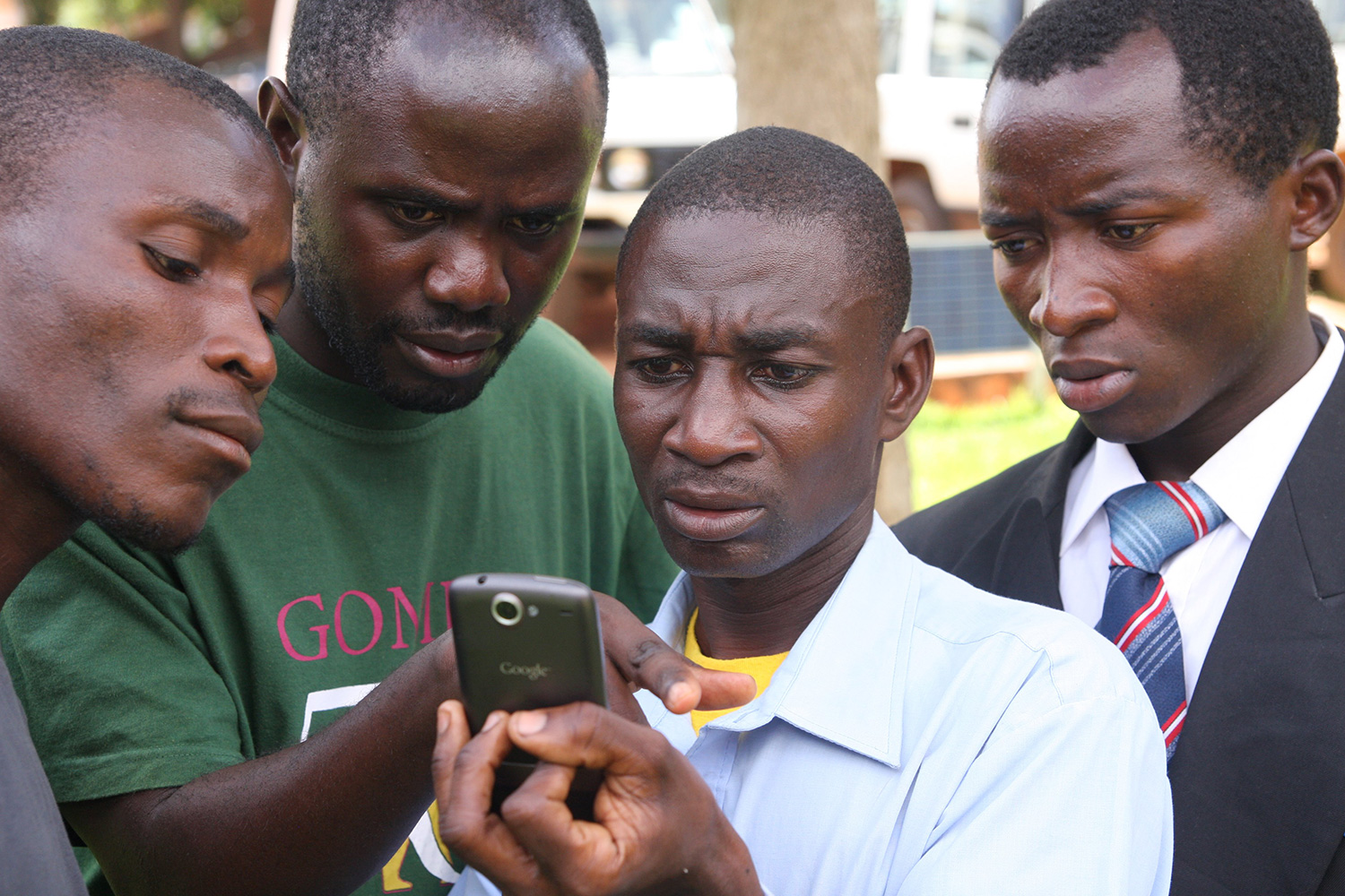
These Android smartphones gave village forest monitors power.
While data transparency is important, JGI, the local community, and the local government decided to password protect information collected by the village forest monitors. Otherwise it could potentially provide sensitive information for poachers, such as what areas were being monitored, and geographical points of where wildlife were sighted.
JGI’s ultimate goal is engaging and building the capacity of the community to enforce their land-use plans to protect the environment, Pintea said.
“The village government selects the person — we have no say,” Pintea said, about how forest monitors are chosen. “So when we give that mobile phone, it’s not to a person, it’s to the community and to a person, who the community trusted to monitor the forest on their behalf. There’s some social engagement there, and of course at some point there’s pride for him or her to have this phone.”
Training people how to use these phones was easy, but changing their perspectives to why data collection is important, why data should be used to make decisions, and why people need to change their lives to manage forests is hard, and takes time.
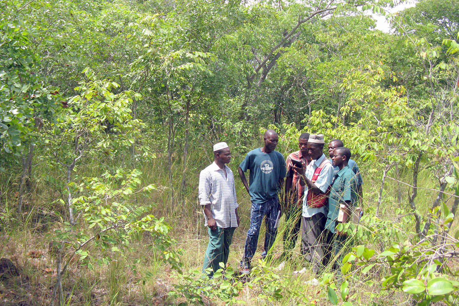

- 3. Forest monitors are training to use Android mobile phones to collect GPS observations of the status and trends of their village forests, wildlife, and threats.
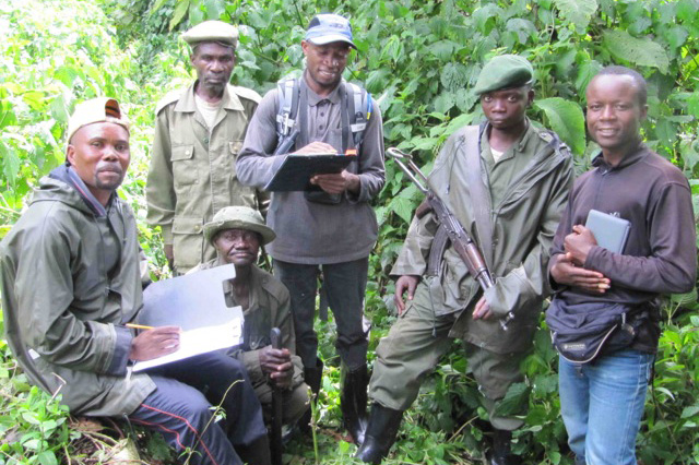
- 4. A Conservation Action Plan workshop: A series of meetings led by the Jane Goodall Institute to identify strategies and actions to reduce the threats to great apes and their habitat in a critical landscape of the eastern Democratic Republic of Congo.
Still, these Android smartphones gave village forest monitors power. In the past, if someone went to the village chairman and mentioned a large tree cut, with GPS coordinates, the chairman could have brushed it off. Now, the capability to take georeferenced pictures empowers forest
“One village monitor reported a bullet cartridge — he took a picture, and reported it to the cloud,” Pintea said. “He said, ‘I took the picture because I went to my village chairman, and said I never saw a bullet cartridge on our village land, but now it’s because the forest is restoring — wildlife is coming back, and so are wildlife hunters.’ He doesn’t need a sophisticated statistical analysis to convince the chairman that the village needs to deal with a new threat.”
Going back with Street View
Smartphones and tablets are just one part of the equation. Now, Pintea and the team are using drones, and he’s also working with the Google Street View team.
“It’s not necessarily obvious that Street View would be applicable for conservation.”
“It’s been really interesting watching this partnership evolve over the last 10 years in ways we never could have predicted,” Tanya Birch, program manager on Google Earth Outreach, told Digital Trends. “As we’re building the next new exciting thing that’s coming out from Google, I always think about how could JGI use this — you know it’s not necessarily obvious that Street View would be applicable for conservation.”
When Pintea saw Google’s Street View launch, he immediately thought of ways it could help JGI work in land-use planning and habitat conservation. It’s why in 2013, he and his colleagues carried backpacks equipped with cameras from Google in 2013 and trekked his way through Gombe, street view mapping areas JGI wanted to monitor in the future. The plan is to return this summer and do a similar trek, thankfully with a much smaller 360-degree camera. That way, they can compare the two data sets to see how the environment has changed on the ground level, complementing the perspective from the satellite level. Pintea called it “ground-truthing satellite imagery.”
What are the results?
Gombe acted as a testing ground for the village forest monitoring project, and JGI’s efforts to engage the community in following land-use plans has paid off. Take a look at the two pictures below:
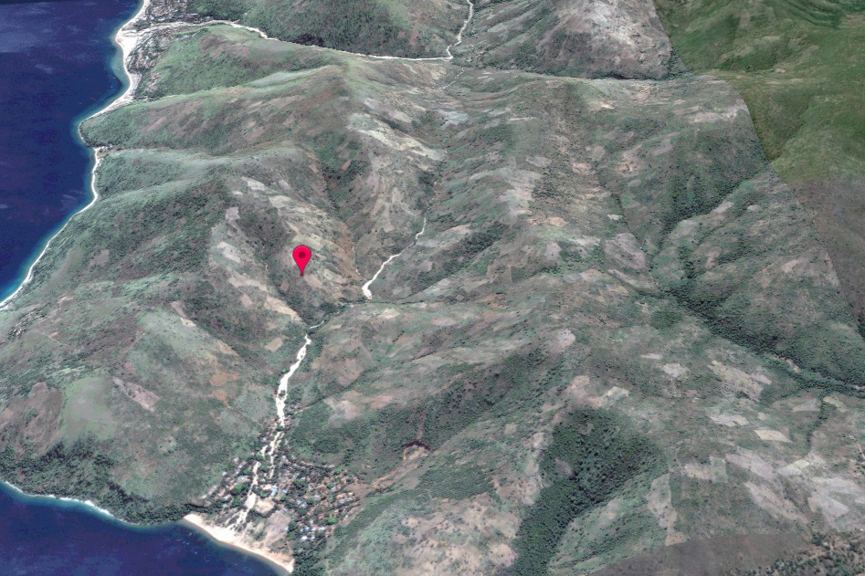
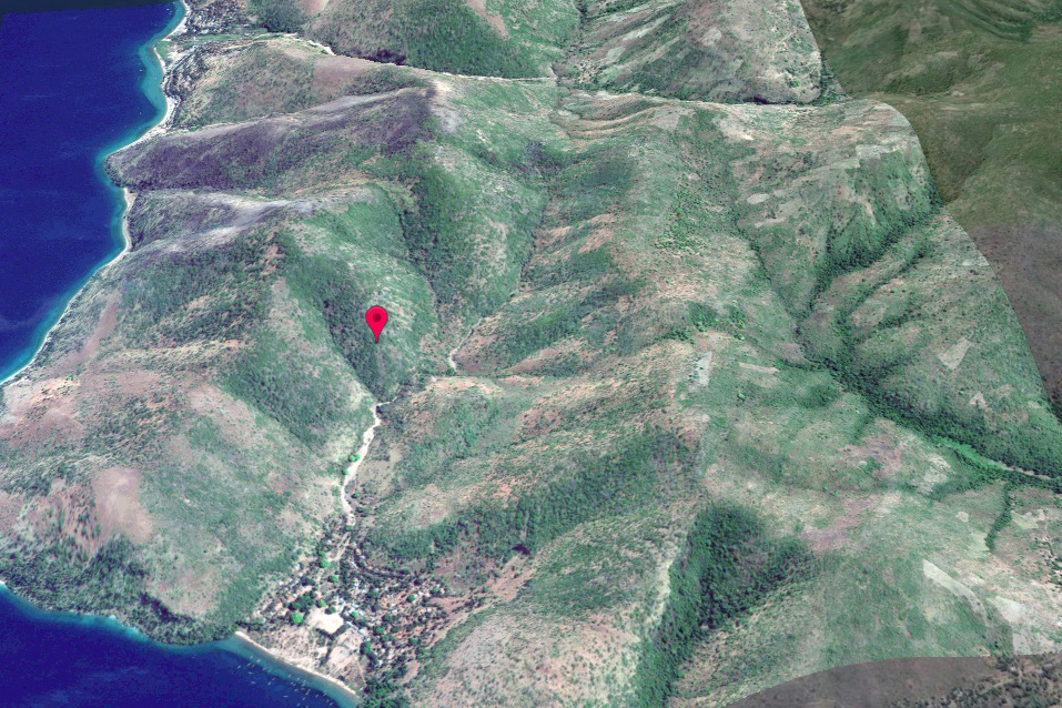
Trees are growing again. The area surrounding Gombe is no longer just bare hills.
Google, JGI, Global Forest Watch, and the World Resources Institute also helped create a forest-monitoring app, which is now in a beta pilot program in Uganda and other countries around the world. The Forest Watcher app offers near real-time tree cover loss data via satellites, and it can send notification alerts to users about potential illegal logging activities. JGI expanded its village forest monitoring model to Uganda, where it now engages more than 200 community members and protected area rangers.
“I think with Google Earth and its storytelling capabilities — I see a lot of exciting promise for more stories we can develop, giving other people a global understanding of what’s happening in the world,” Birch said.
What technology and groups like JGI have done also democratize the process of research gathering all over the world. Before, a scientist would get a government’s approval, pay a fee, and hire locals as guides. Now, the process could involve engaging the local community to help gather data, while paying them as well.
“The word empowering is so overused,” Birch said. “But it really fits here. Suddenly, people are listening to you. It’s not just, ‘I saw some deforestation over there,’ ‘yeah, who cares?’ Maybe a few people, but when it’s many, many people all recording information which feeds into a global map of deforestation — then you can start talking about how that factors into climate change and global processes. Data collected on the ground is a critical piece of the puzzle.”
In other words, this data and work is influencing national and global decisions about climate change. But for the Jane Goodall Institute, it also goes back to saving the chimpanzees.
Editors' Recommendations
- How to save your data from Google’s purge of inactive accounts
- The Google Pixel Watch isn’t great, but it could still save Wear OS
- Google Play Store helps find the apps invading your privacy
- Google I/O 2021: How to watch the keynote today
- How to move your Google Play library over to YouTube Music