
Google Street View hits an ace with 360 view of the Ryder Cup

ryder cup hazeltine street view
Image used with permission by copyright holder
The very best golfers from the U.S. and Europe are once again about to face off in what has to be one of sports most enthralling contests – the Ryder Cup.

Teeing off on Friday at the Hazeltine National Golf Club in Chaska, Minnesota, the two teams, led by America’s Davis Love III and Europe’s Darren Clarke, will play the competition over three days, with the U.S. team focused on securing victory for the first time since 2008.

Ramping up interest in this week’s sporting showdown, Google’s Street View has teamed up with broadcaster Turner Sports and interactive mapping specialist Ubilabs to give golf fans around the world a unique chance to get out on the course.

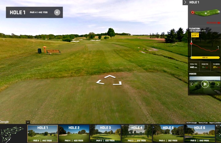
You can explore the 360-degree imagery of Hazeltine via Google Maps, but a far more fascinating experience comes via the Hazeltine Explorer, which features an interactive tour offering oodles of course data for dedicated Ryder Cup followers.

You’ll find custom elevation graphs for every hole, integrated video highlights, and course-specific historical moments, Google’s Vanessa Schneider explained in a post highlighting the new content.

And if you’re lucky enough to be attending the event, be sure to download the dedicated Ryder Cup app (iOS and Android) that besides live scores and player information also offers a detailed map of the Hazeltine course, including amenities and routing instructions for walking paths and crosswalks.

Turner Sports' Randy Dickerson captures imagery from Hazeltine.
Turner Sports’ Randy Dickerson captures imagery at Hazeltine. Image used with permission by copyright holder

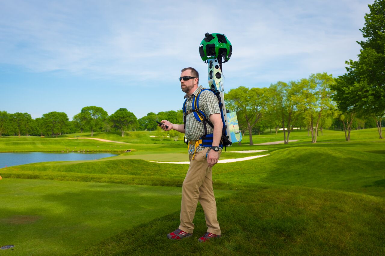
To photograph Hazeline, Turner Sports’ Randy Dickerson (above) dutifully walked more than five miles carrying one of Google’s 40-pound Trekker backpacks, though Schneider notes that he did manage to sneak rides on a golf cart here and there.

Editors' Recommendations

Trevor Mogg
Contributing Editor
Not so many moons ago, Trevor moved from one tea-loving island nation that drives on the left (Britain) to another (Japan)…
Apple Maps expands its Street View-style imagery to 3 more cities
apple maps expands street view style imagery to more cities look around

Apple Maps began adding Street View-style imagery with the launch of iOS 13 last year. But at the start, the Look Around feature only worked for the streets of San Francisco.

The good news is that the tech giant is gradually adding new Look Around content to Apple Maps for mobile, with the most recent additions including imagery for the cities of Philadelphia, Boston, and Washington D.C. Other cities added in recent months include New York City, Los Angeles, Las Vegas, Houston, and Oahu in Hawaii.

Read more
Google reveals how many miles its Street View cars have driven to date
street view cars pollution data car

As if you didn’t already know it, Google’s Street View cars have been going here, there, and everywhere since the first camera-equipped vehicle took to the streets more than a decade ago.

The web giant has just revealed that Street View has now captured more than 10 million miles of imagery from around the world, a distance which, if driven in a straight line, would circle Earth more than 400 times.

Read more
Google Maps working on feature that shows well-lit streets?
Google Maps

Google Maps, which is continually releasing new features and updates to further improve the experience for its millions of users, reportedly has another one in the pipeline that will focus on making navigation at night safer.

XDA Developers spotted code in the Google Maps v10.31.0 beta that reveal the Lighting Layer, which will show streets that have good lighting. Activating the feature will highlight well-lit streets in yellow, and there will also be indicators for streets with poor to no lighting.

Read more