
Apple’s own site clearly states its intentions with these vehicles. “Apple is driving vehicles around the world to collect data which will be used to improve Apple Maps. Some of this data will be published in future Apple Maps updates.” You can also go here to track the vans’ locations; from February 1 through Valentine’s Day, the driving locations include areas in London, Paris, and multiple cities across the United States.
It is likely that Apple Maps will see a major update with the release of iOS 10 this summer, so expect the van deployment to shift into overtime until then. The update is most likely to occur at the annual Worldwide Developers Conference in June.
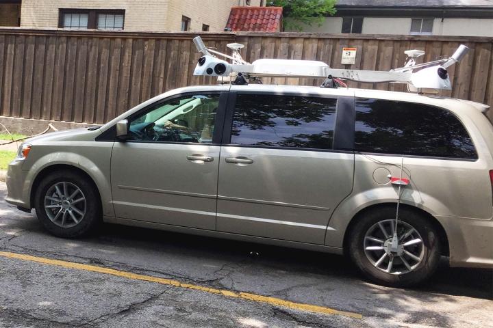
Even without the app’s logos, you can easily spot the vans by the equipment mounted to the roof, including cameras, LiDAR, and GPS. These sensors ensure that the road is where it should be on the map, and they also provide a platform to take photos from. If you think this is sounding more like Google’s Street View, you’re right. It is also speculated that Apple will introduce a nighttime version of this feature (unless the vans are working after hours just to catch up).
With Google having a good head start in the mapping department, it remains to be seen how much coverage Apple can acquire even as its competition continues to update its own software.
Editors' Recommendations
- Here’s how Apple could change your iPhone forever
- We now know when Apple is adding RCS to the iPhone
- What is Wi-Fi calling, and how does it work?
- Apple is about to change iPhone web browsing forever
- Google is bringing Chrome browser to cars, even more EV features to Maps


