 Don’t get me wrong, Street View is an incredible tool, one that, for example, allows armchair travelers to explore parts of the world they might not otherwise have a chance to visit. It is, however, all a bit slow, a bit static, especially when you want to ‘drive’ from one location to another.
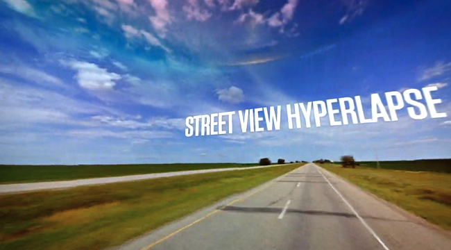
Thanks to some sterling work by Canadian Web agency Teehan+Lax, you can now use Street View to travel vast distances in a matter of seconds. Its rather remarkable software pulls pictures from Google’s gargantuan database of images before stitching them together to make a so-called ‘hyperlapse’ animation of your journey.
Hyperlapse videos – which combine time-lapse photography with sweeping camera movements – can be found across the Web, but creating them means a lot of work involving taking the photos and stitching them together. Teehan+Lax’s Street View Hyperlapse software, however, makes it simple.
The online tool lets you create your own hyperlapse animation by simply dragging and dropping ‘A’ and ‘B’ markers onto any locations on Google Maps and hitting the create button. Admittedly, the results can be a bit on the bumpy side, but you can smooth things out by dragging the picture around the screen so you keep looking straight ahead. Check out the video below to see what’s possible.
This from the agency’s blog:
“The site settings are purposely low (like having a maximum of 60 frames per animation) for greater accessibility. However, all the source code is available on Github (including examples and documentation) so developers can play with higher frame rates, better image quality, and more complicated camera movements.
“The idea for this project came from one of our motion designers, Jonas, as part of his Labs experiment. He wanted to explore a tool that could help him create hyperlapse videos with the assistance of available data sets and emerging technology. We built the tool – he built a video with it. The results are pretty stunning.”
The team says the tool works best with Chrome, while a “decent” machine is required to create and watch the journeys.
Editors' Recommendations
- Stability AI’s music tool now lets you generate tracks up to 3 minutes long
- Zoom’s new AI tools will let you ditch meetings for good
- TikTok to let you design and publish your own AR effects
- Mozilla Firefox’s new add-on lets you surf the web with your voice
- Gmail update lets you easily attach emails to your emails