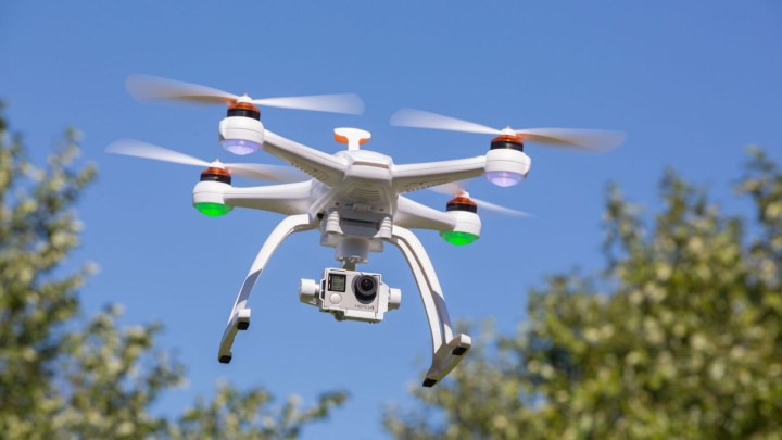
Washington D.C.’s ‘no fly zone’ for drones just got extended by 30 miles

dc drone no fly zone extended best drones under  500
It’s hard out here for a drone. While just about anyone can fly them these days, where they can be flown is quite a different story. On Christmas , the Federal Aviation Administration decided to further extend the drone ban further into Virginia and Maryland, increasing the radius of the “no-drone zone” by 30 miles outside Washington, D.C. While the nation’s capital has long maintained strict standards over the presence of these unmanned flying objects, it seems as though the iron fist is closing in tighter and tighter around these devices, and soon there may be nowhere to fly them. Not legally, at least.

“Unmanned aircraft, including model aircraft, are ‘aircraft’ and are subject to FAA rules,” an administration spokesperson told eWeek via email. “No aircraft is allowed to fly inside the Special Flight Rules Area (SFRA) unless it complies with the published airspace security requirements. All aircraft flying in the Washington, D.C., SFRA are required to squawk a discrete beacon code and maintain continuous radio communications with air traffic controllers. Aircraft that cannot meet these requirements are prohibited from operating within the SFRA without specific authorization.” And while that seems like a lot of jargon, the simplest way to put it is this: You can’t fly a drone anywhere near D.C.

And it’s not just in our capital where these regulations are being enforced. Indeed, around two dozen states have passed legislation regarding drones, and major cities including Chicago, Los Angeles, and Miami, have rules on where drones can and can’t be flown. Failure to comply with these regulations result in both criminal and financial repercussions, and lawmakers say that they’re hoping to keep residents safe from both prying eyes and potential dangers carried by drones.

“It is important for you to tell your viewers that they cannot fly in the 30-mile radius,” an FAA official told WUSA9, a local station in D.C. “The FAA will continue to do outreach to educate the public.”

Editors' Recommendations

Lulu Chang
Former Digital Trends Contributor
Fascinated by the effects of technology on human interaction, Lulu believes that if her parents can use your new app…
Twitter explodes as 5.9 magnitude earthquake hits Virginia, Washington D.C., NYC
virginia-earthquake-5.9

A 5.9 magnitude earthquake rocked much of the East Coast today, according to the US Geological Survey. The epicenter of the quake was located in Mineral, Virginia, which is in the middle of the state, about 45 miles Northwest of Richmond, VA. Tremors of the quake were felt more than 300 miles away, in New York City, and towns in northern New York state and elsewhere.
(Your reporter lives about two hours north of New York City, and I felt it here.)
Due to its relatively close proximity to Washington D.C., both the Pentagon and the Capitol Building, where pictures reportedly fell off the walls, were evacuated. Some firms on Wall Street also halted trading and evacuated due to the quake. So far, no major injuries or fatalities have been reported.
As of this writing, Verizon cell phone voice service was down for the greater New York area, though text messages were going through fine.
The USGS originally reported that the quake measured 5.8 on the Richter scale, but later upped the count to 5.9.
The largest recorded earthquake before today's was a mere 3.6 in magnitude.
Of course, the most dynamic way to see the response to the quake was on Twitter, which, from your reporter's observations, erupted with tweets mere seconds after Earth's crust halted its violent shaking.
As with most recent breaking news stories, the best way to get up-to-the-second news and updates about the earthquake is on Twitter. Really, the only downside to using Twitter as a new source right now is that so many tweets are being posted about the quake that it's impossible to keep up with all the news.
To see the most recent tweets related to the East Coast earthquake, click here.

Read more
Why AI will never rule the world
image depicting AI, with neurons branching out from humanoid head

Call it the Skynet hypothesis, Artificial General Intelligence, or the advent of the Singularity -- for years, AI experts and non-experts alike have fretted (and, for a small group, celebrated) the idea that artificial intelligence may one day become smarter than humans.

According to the theory, advances in AI -- specifically of the machine learning type that's able to take on new information and rewrite its code accordingly -- will eventually catch up with the wetware of the biological brain. In this interpretation of events, every AI advance from Jeopardy-winning IBM machines to the massive AI language model GPT-3 is taking humanity one step closer to an existential threat. We're literally building our soon-to-be-sentient successors.

Read more
The best hurricane trackers for Android and iOS in 2022
Truck caught in gale force winds.

Hurricane season strikes fear into the hearts of those who live in its direct path, as well as distanced loved ones who worry for their safety. If you've ever sat up all night in a state of panic for a family member caught home alone in the middle of a destructive storm, dependent only on intermittent live TV reports for updates, a hurricane tracker app is a must-have tool. There are plenty of hurricane trackers that can help you prepare for these perilous events, monitor their progress while underway, and assist in recovery. We've gathered the best apps for following storms, predicting storm paths, and delivering on-the-ground advice for shelter and emergency services. Most are free to download and are ad-supported. Premium versions remove ads and add additional features.

You may lose power during a storm, so consider purchasing a portable power source,  just in case. We have a few handy suggestions for some of the best portable generators and power stations available. 

Read more