
Google recently announced that it will add live transit tracking to its Maps application, so it was only a matter of time until Apple did the same with its own Maps application. The company showed off the new transit feature in Maps at WWDC 2015 during its opening keynote reveal of iOS 9.
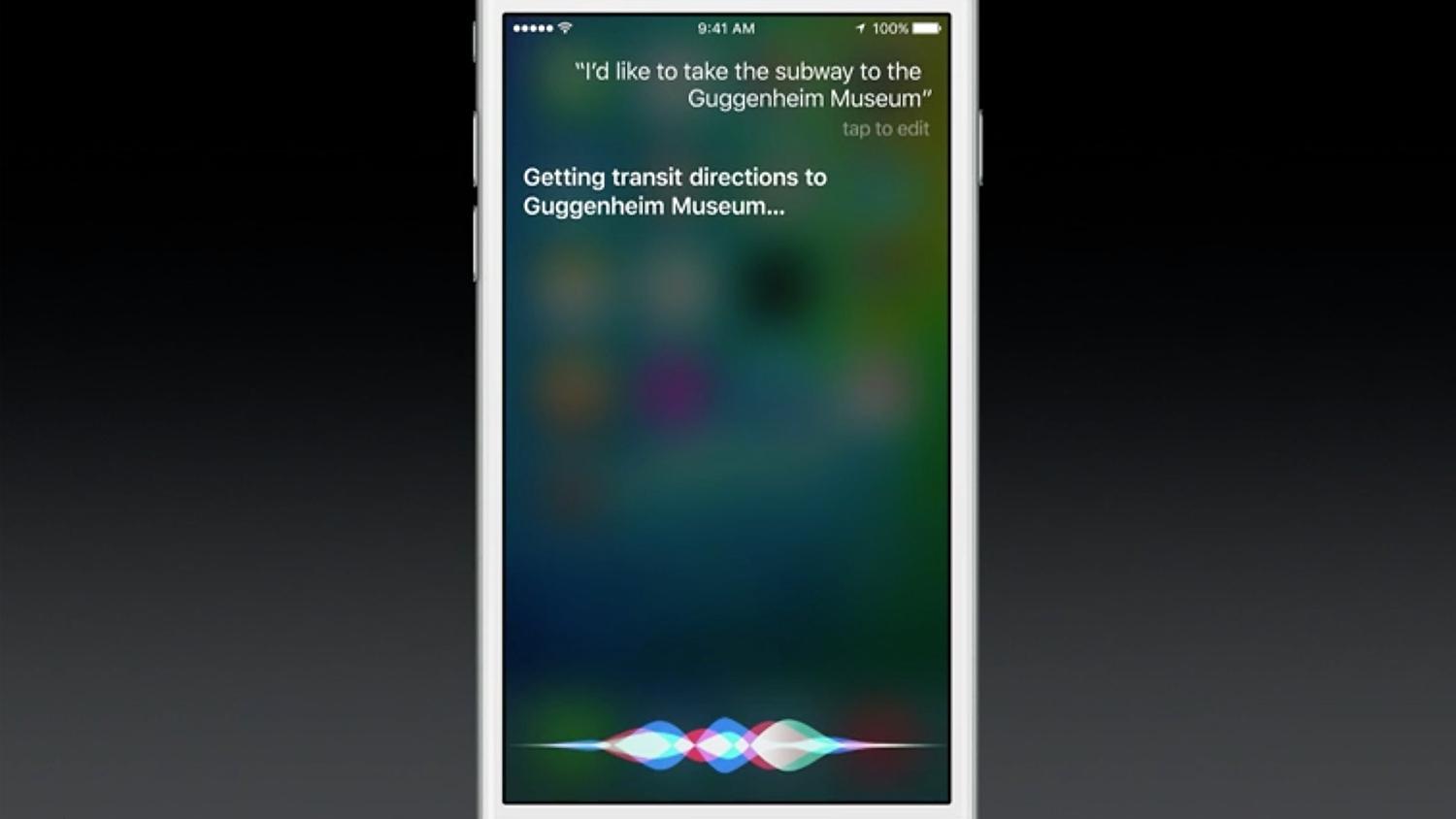
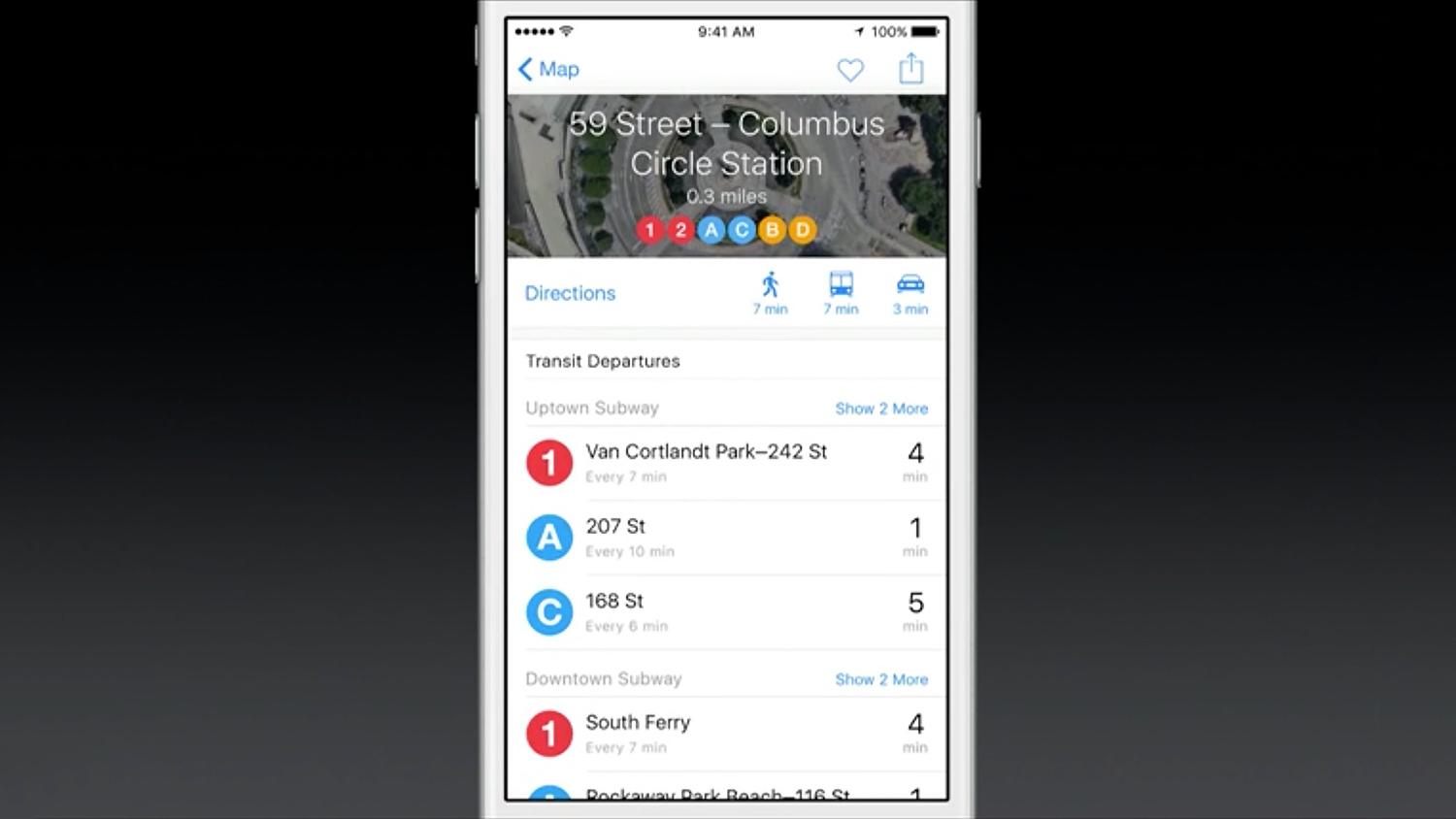
When you tap on a station in the new Apple Maps app, you can see all the lines that run through it, as well as when those lines will arrive at the station. In addition, there’s also “multi-modal routing,” in case you want to switch from a train to a bus mid-journey, or vice-versa. More interesting, Maps knows the entrances and exits of various train and subway stations, and uses that information to adjust travel times. So if you’re coming out of the 42 Port Authority train station in New York, for example, Apple Maps may add a few minutes to your travel time to account for the long walk through that massive station.

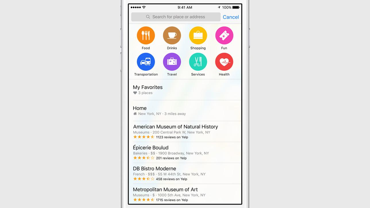

In addition to transit directions, location cards in Maps will now show you whether nearby merchants support Apple Pay. These location cards also reveal popular shops, restaurants, and activities in your vicinity, along with the distance between you and the location, as well as user reviews of the closest shops and restaurants.
Transit directions will make their way to select cities when iOS 9 launches later this fall. The cities initially supported include Baltimore, Berlin, Chicago, London, Mexico City, New York, Philadelphia, San Francisco, Toronto, and Washington, D.C. In addition, Apple will roll out transit directions to Beijing, Shanghai, Shenzhen, and 300 other Chinese cities. Many more cities are expected to join this elite group in the near future.
Editors' Recommendations
- We finally know when Apple will announce its 2024 iPads
- This one thing could make iOS 18 the best iPhone update in years
- Apple finally has a way to defeat ChatGPT
- Apple just announced the dates for WWDC 2024
- Nvidia and Apple are collaborating on the Vision Pro in the most unlikely way