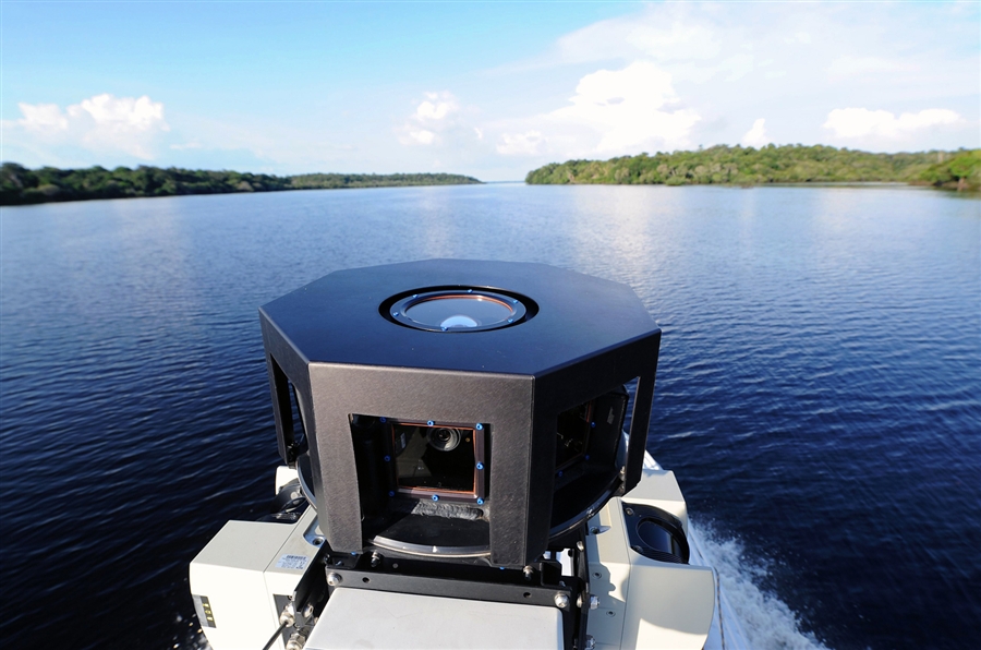
In a partnership with the Sustainable Amazon Foundation, a team from Google has taken it upon themselves to map out the endangered South American rainforest as well as collect photo data of the communities of people that live there. To start, Google mounted the cameras on boats that travel the Rio Negro and Amazon rivers to create 360-degree panoramics of the waters and dense forest. On land, Google is using tricycles to navigate along dirt roads rather than automobiles. The trike looks very similar to a portable ice cream vendor, but has a large pole protruding upwards with the camera mounted on top. The back of the trike is painted with the Google maps logo and appears to have storage for the rider’s belongings as well as a metal container.
 The team from Google is planning to train locals how to use the equipment for further, in-depth mapping after they get an initial map of the area and charity workers with the SAF will help upload the data back to Google. While Google’s Street View cameras have been shunned in countries like Austria and Germany, the locals have welcomed the cameras. The cameras will also be used to capture images within businesses and schools in the area. The Sustainable Amazon Foundation is looking to promote awareness of the indigenous population to the rainforest with the partnership with Google.
Google doesn’t have a timeline on when the project will be finished, but phase one starts in the town of Tumbira and works down a 30-mile stretch of the Rio Negro river. Google’s last impressive project involved mapping out Antarctica with photos to create an armchair tour of the area. Google has also added footage from the Australian outback, Palace of Versailles, Pompeii, African plains and beachfront areas in Brazil to Street View.

Editors' Recommendations
- Google deploys a Jaguar I-Pace as its first all-electric Street View car
- Google reveals how many miles its Street View cars have driven to date