
NASA wants the public’s help with mapping out the surface of Mars, to eventually help make driving rovers like Curiosity around the red planet a bit easier.
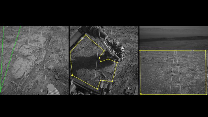
NASA has an algorithm called SPOC (Soil Property and Object Classification), which labels different types of Mars terrain such as boulders or sand to create maps that the rover driver can use when maneuvering the vehicles. But the system is in need of refining, and that requires inputting a huge amount of data.
“Typically, hundreds of thousands of examples are needed to train a deep learning algorithm,” Hiro Ono, an A.I. researcher at NASA’s Jet Propulsion Laboratory, said in a statement. “Algorithms for self-driving cars, for example, are trained with numerous images of roads, signs, traffic lights, pedestrians, and other vehicles. Other public datasets for deep learning contain people, animals and buildings — but no martian landscapes.”
To help with the task of training the algorithm, NASA is inviting the public to help classify bits of martian terrain. The public can use the AI4Mars tool to draw boundaries around objects in the terrain and label them as sand, soil, bedrock, or big rocks. This will help teach SPOC to distinguish between different parts of the terrain, which can be used in future rover navigation.
“In the future, we hope this algorithm can become accurate enough to do other useful tasks, like predicting how likely a rover’s wheels are to slip on different surfaces,” Ono said.
The idea is not to replace human drivers with SPOC, as humans are still definitely required for the highly complex task of navigating a rover around another planet. But the algorithm can help them with some of the more tedious parts of their work, freeing them up to concentrate on more scientifically interesting tasks.
“It’s our job to figure out how to safely get the mission’s science,” said Stephanie Oij, one of the lab’s rover planners involved in AI4Mars. “Automatically generating terrain labels would save us time and help us be more productive.”
You can start labeling terrain and helping out the rover drivers at the AI4Mars website.


