
How researchers use impact craters on Mars to date geological events

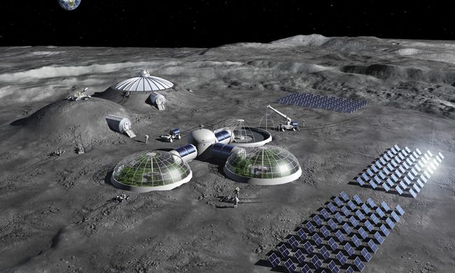
While rovers visiting the surface of Mars are invaluable research tools for understanding surface chemistry and other questions, observing Mars from orbit can help us understand the planet’s history — as recent images of a martian impact crater show.

The Mars Express orbiter uses its High Resolution Stereo Camera (HRSC) instrument to take photographs of the Martian surface, including geographical features and locations of water ice. Recently, ESA has shared images created from HRSC data of deep gouges on the surface of the Tantalus Fossae region. These troughs are part of a fault system that stretches nearly 1,500 miles across and are located around the edges of a low-lying volcano called Alba Mons.

Related Videos
This image from ESA’s Mars Express shows part of a large fault system on Mars known as Tantalus Fossae. This image comprises data gathered by Mars Express’ High Resolution Stereo Camera (HRSC) on 19 July 2021. It was created using data from the nadir channel, the field of view aligned perpendicular to the surface of Mars, and the colour channels of the HRSC. It is a ‘true colour’ image, reflecting what would be seen by the human eye if looking at this region of Mars.
This image from ESA’s Mars Express shows part of a large fault system on Mars known as Tantalus Fossae. This image comprises data gathered by Mars Express’ High Resolution Stereo Camera (HRSC) on 19 July 2021. ESA/DLR/FU Berlin

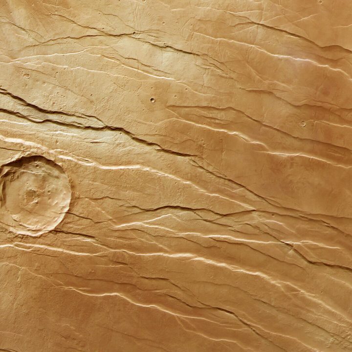
“The fossae were created as the summit of Alba Mons rose in elevation, causing the surrounding surface to become warped, extended, and broken,” ESA explains. “The Tantalus Fossae faults are a great example of a surface feature known as grabens; each trench formed as two parallel faults opened up, causing the rock between to drop down into the resulting void.”

This oblique perspective view of Tantalus Fossae on Mars was generated from the digital terrain model and the nadir and colour channels of the High Resolution Stereo Camera on ESA’s Mars Express.
This oblique perspective view of Tantalus Fossae on Mars was generated from the digital terrain model and the nadir and color channels of the High Resolution Stereo Camera on ESA’s Mars Express. ESA/DLR/FU Berlin

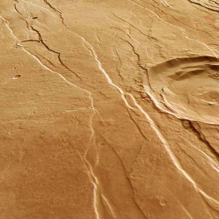
Another image shows the same region but from a different angle, as generated from digital information collected by the HRSC instrument and others. By bringing together information about elevation and surface features from different instruments, digital terrain models can be generated that show what the terrain looks like in three dimensions.

The large crater shown in the images can be helpful in dating the grabens features. The crater would have been caused when a chunk of rock or ice came streaming through the thin atmosphere and hit the planet, throwing up debris and creating a shock wave that forms a circular shape in the surface rock. The force of this impact would obliterate any surface features which existed there previously.

As the grabens can be seen running across the impact crater, they must have been formed after the impact occurred. This is one way that geologists build up a picture of the history of distant bodies like Mars or the moon, by looking at the age of certain geological events relative to particular impact craters. This impact crater is an old one, and it was already present on the surface when the Alba Mons volcano started pushing up to the surface and forming the faults of Tantalus Fossae.

If you look carefully at the top image, you can see another impact crater, much smaller and located at the bottom left of the main crater, which cuts across the fault lines. That suggests it is much younger and was created by an impact that occurred after the fault system formed.

Editors' Recommendations

NASA Mars rover has discovered an alien rock
A meteorite discovered on Mars in 2023.

While NASA’s newer Perseverance rover usually gets all the headlines, 11-year-old Curiosity continues to trundle across the surface of Mars in search of interesting discoveries. And it’s just made one.

Ashley Stroupe, mission operations engineer at NASA's Jet Propulsion Laboratory (JPL), which is overseeing the Curiosity mission, said on JPL’s website last month that the rover had happened upon a 1-foot-wide rock that “seems to have come from elsewhere.”

Read more
NASA’s Mars rover has just completed a historic task
NASA's Perseverance rover on Mars.

Less than six weeks after it began the task, NASA’s Perseverance Mars rover has completed what the space agency is calling “humanity’s first sample depot on another planet.”

https://twitter.com/NASAJPL/status/1620110707877617666

Read more
Mars helicopter Ingenuity marks 40 flights and is still going strong
Ingenuity sits on a slightly inclined surface with about 6-degree tilt at the center of the frame, just north of the southern ridge of “Séíitah” geologic unit. The Perseverance rover’s Mastcam-Z instrument took this image on Dec. 1, 2021, when the rotorcraft was about 970 feet (295 meters) away.

The Mars helicopter Ingenuity has made its third flight of the year, which also marks its 40th flight since it landed in the Jezero crater along with the Perseverance rover in February 2021. Despite being originally intended for just five flights and having to weather the Martian winter, the little helicopter is still going strong as it comes up to its second anniversary on the red planet.

On the helicopter's 40th flight, it traveled from an area named Airfield Z to Airfield Beta, on its way to join the Perseverance rover as it explores the Jezero river delta. It will help scout ahead for the rover, identifying safe routes for the rover to drive as it searches for evidence of ancient life that could have existed when water was present on the planet's surface billions of years ago.

Read more