
Researchers use satellites to track ocean microplastics from space

Environmentalists have been raising awareness about the problems caused by microplastics in the oceans — tiny pieces of plastic which can harm marine animals and damage ecosystems. But it’s hard to say how widespread the issue is, as it’s difficult to track all of the plastic in the ocean.

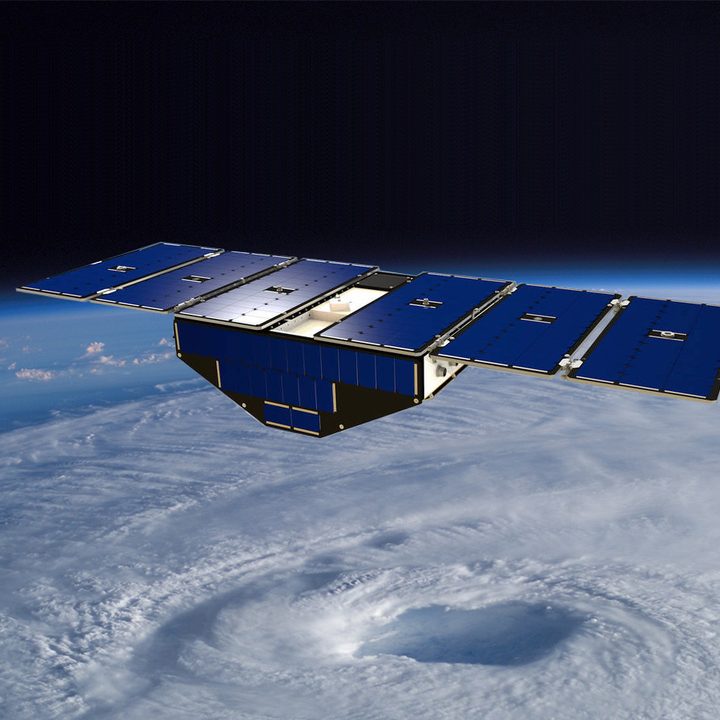
Now, researchers are using a NASA satellite to track how plastics move throughout the ocean. The Cyclone Global Navigation Satellite System (CYGNSS) is a set of eight small satellites that was, as the name suggests, designed to track hurricanes and to understand the formation of storms. But researchers at the University of Michigan realized they could use data from the satellite system to both track microplastics on a global scale and to zoom into specific areas to get high-resolution data.

“We’re still early in the research process, but I hope this can be part of a fundamental change in how we track and manage microplastic pollution,” said senior author Chris Ruf.

Illustration of one of the eight CYGNSS satellites in orbit above a hurricane.
Illustration of one of the eight CYGNSS satellites in orbit above a hurricane. NASA

The satellites were already measuring the roughness of the ocean surface as part of their hurricane monitoring job. Ruf and his colleagues realized they could take this existing data and identify areas that looked smoother than they should, given the wind speed. This correlates well with the presence of microplastic, letting them track this issue globally.

“We’d been taking these radar measurements of surface roughness and using them to measure wind speed, and we knew that the presence of stuff in the water alters its responsiveness to the environment,” Ruf said. “So I got the idea of doing the whole thing backward, using changes in responsiveness to predict the presence of stuff in the water.”

The results show that the concentration of microplastics changes with the seasons, and converges in places like the infamous Great Pacific Garbage Patch. They also found a high concentration of microplastics at the mouth of the Yangtze River, the longest river in Asia. This area had previously been thought to be a primary source of microplastics, but this new evidence shows the problem in action.

“It’s one thing to suspect a source of microplastic pollution, but quite another to see it happening,” Ruf said. “The microplastics data that has been available in the past has been so sparse, just brief snapshots that aren’t repeatable.”

Editors' Recommendations

Georgina Torbet
Georgina is the Digital Trends space writer, covering human space exploration, planetary science, and cosmology. She…
Hubble scientists create tool for erasing satellite trails from images
This image captures the streak of an Earth-orbiting artificial satellite crossing Hubble's field of view during an observation of "The Mice" interacting galaxies (NGC 4676). A typical satellite trail is very thin and will affect less than 0.5% of a single Hubble exposure. Though in this case the satellite overlaps a portion of the target galaxy, the observation quality is not affected. That's because multiple exposures are taken of the same target. And the satellite trail is not in other frames. Developers at the Space Telescope Science Institute in Baltimore, Maryland, have software that identifies the bad pixels from the satellite photobombing, the extent to which they affect the image, and then flags them. When flagged, scientists can recover the full field of view. Even as the number of satellites increases over the decade, these tools for cleaning the images will still be applicable.

With ever-increasing numbers of satellites in the sky, astronomers have repeatedly expressed worry over how these satellites could impact scientific research. Earlier this year, a study of Hubble Space Telescope observations showed how some images were being ruined by streaks of light coming from satellites -- and while only a small percentage of Hubble images were affected, the authors raised concerns that with the projected number of satellites set to explode in the next decade, the problem could become serious.

Now, astronomers at the Space Telescope Science Institute (STScI), which runs Hubble, have come up with a tool to deal with satellite streaks in Hubble images. "We developed a new tool to identify satellite trails that is an improvement over the previous satellite software because it is much more sensitive. So we think it will be better for identifying and removing satellite trails in Hubble images," said Dave Stark of STScI in a statement.

Read more
Watch this awesome tracking footage of a SpaceX rocket coming home
A SpaceX Falcon 9 booster coming in to land.

SpaceX recently released some stunning footage (below) showing one of its Falcon 9 boosters returning to Earth shortly after launch.

https://twitter.com/SpaceX/status/1664832049516097537

Read more
Astronomers discover three exoplanets in final data from Kepler Space Telescope
An artist's concept of the Kepler spacecraft.

The Kepler Space Telescope was retired in 2018 after a nine-year mission that saw it discover an incredible 2,600 confirmed exoplanets, kicking off the modern era of exoplanet research. But now there are three more exoplanets to add to the mission's total, even after the telescope has been dark for the last five years. Astronomers were recently able to use data from the very last observations of Kepler to discover three more planets.

Two of the three exoplanets have been confirmed -- K2-416 b and K2-417 b -- with a third planet, EPIC 246251988 b, remaining an exoplanet candidate. (To be upgraded from exoplanet candidate to confirmed exoplanet, an initial observation has to be verified through observations by two other telescopes.) The planets range from 2.6 times the size of Earth to 4 times the size of Earth, making them small in comparison to most discovered exoplanets.

Read more