In some places, the so-called “wildfire season” is now all year round. As the disruptive effects of climate change descend on the planet, one manifestation of its presence is extremes of melting arctic ice, rising ocean levels, intense hurricanes and tornadoes, and persistent wildfires. While in the past, it was primarily scientists, meteorologists, universities, the government, and hobbyists who tracked wildfires, these days a sizable portion of the population now either lives in a fire zone or knows someone who does. That personal connection with wildfires brings online tools and mobile fire-tracking apps into the spotlight.
A number of informative websites help you to track both emerging and historical wildfire activity and escape routes, while apps, synced to that information, let you check the status whenever you want. Many apps and sites use sources like InciWeb, a U.S. interagency incident management system run by the National Wildfire Coordinating Group, which collects wildfire incident data. They may also derive data from Cal Fire, the U.S. Geological Survey, NASA, and a host of other U.S. government agencies that monitor wildfires all over the world.
Here are some of the high-quality sites and mobile apps we found for tracking wildfires.
Websites
NASA WorldView
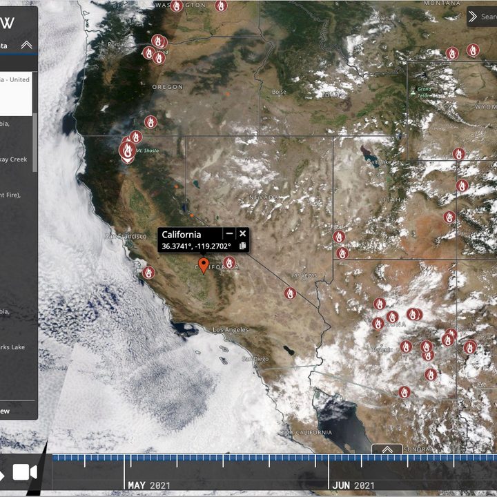
The WorldView section of NASA’s website lets you customize your view of any number of climactic events, including wildfires. Choose from a large array of recent events, and then add layers to customized maps that clarify information about your topic. Layers may include a large number of hazards and disasters or scientific disciplines. A featured section lets novices zero in on popular ways to view and analyze the data. A data column superimposes overlays of additional information as you click the various choices. The site is visual and lets you see both current and past information in a pleasing way.
Fire, Weather, and Avalanche Center
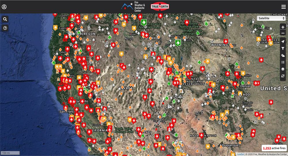
The Fire, Weather, and Avalanche Center, a 501(c)(3) non-profit, helps you stay updated on the latest wildfire, weather, and snow information. It lets you view where the most current fire activity is going on near your location. With a click, you can see where the fires are. The site makes user-friendly services and information accessible to the public while emphasizing backcountry locations where information is often hard to collect.
iOS and Android apps
Fire Finder — Wildfire Info ($1)
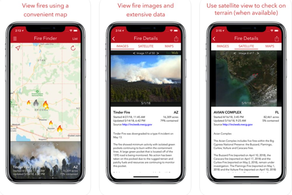
With the Fire Finder app, you can easily look up information and images of any wildfire in the U.S. It maps fire outbreaks on a satellite map and lets you search for the fire you want to follow. It maps wildfire locations and fire perimeter data, features a sharable photo gallery, and provides fire information from a host of state and federal sources, like InciWeb and Cal Fire.
Wildfire Info (free)


If you’re tracking wildfires around the globe, Wildfire Info gets you up-to-the-minute details about current wildfires and prescribed burn activity for locations in the U.S., Canada, Europe, Australia, and more. It features Integrated Reporting of Wildland Fire Information (IRWIN) current wildfire perimeters. Though not live, the data is updated every five minutes to track changes to perimeters posted to the National Incident Feature Service (NIFS), derived from operational data as opposed to ground conditions. Thermal hotspot maps by region show wildfire activity in the past 48 hours from the NASA MODIS and VIIRS satellites. The app also includes InciWeb and Cal Fire active fire maps, new wildfire weather and situation reports, CHP incidents, and an aggregated wildfire news wire. New features include a Traffic layer available throughout the app by default that you can toggle on and off. A Location Details option from the Map Tools side menu that you can tap for a quick-access pop-up with the address, latitude/longitude, and time zone of the blue Map Tools pin. A button lets you copy the latitude/longitude to your clipboard for use in another app. A searchable Wildfire-Related Twitter Tables now shows city and county if relevant to the source.
Firesource — Live Wildfires (free)

With Firesource, you get a live fire feed that updates upon refresh and settles into a scrollable menu to follow wildfires across the U.S. It also tracks user-reported fires and let you report a fire and upload an image of it. It derives information from InciWeb and Cal Fire in real time, providing the fire’s location and a detailed status. Allowing app users to report a fire and immediately inform other users is an essential role for Firesource. To ensure fire report validity, users must take a photo of the fire and cannot access Camera Roll to select an image. Observers can rate a fire report by confirming that it is active, contained, or spam. The updated version adds fire perimeters with information about acreage, containment, and personnel for the U.S. and interface improvements.
Wildfire — NOAA Fire Map Info


Wildfire Fire Map Info lets you view current wildfires, hazardous condition zones, weather data, news and analysis, and base maps. Information on current wildfires is based on NASA’s near-real-time MODIS and VIIRS I-band fire detection data alongside the U.S. Geological Service (USGS) fire perimeter. Data appears on Google Maps Normal, Satellite, and Terrain maps, USGS topographic maps, or NASA Blue Marble maps. Weather data overlays include NOAA HD Weather Radar, Long Duration Hazards, Short Duration Watches and Warnings, and more. Look for updated SPC Fire Weather Outlook graphics and a free version for Android. The Apple version still costs $1.
Fire weather calculator (free)


Developed by The National Center for Landscape Fire Analysis at the University of Montana’s College of Forestry and Conservation, this professional tool (still in beta) provides an abundance of data sharing and research. The newest version includes anonymous weather observations shared with researchers at the University of Montana to support research in weather prediction, analysis, and content display. The app allows quick calculation of RH, Fine Dead Fuel Moisture (FDFM), and Probability of Ignition (PIG) based on standard fire line weather observations. The app also lets you archive and share observations via email, Dropbox, and Google Drive. New versions add the ability to manually add Relative Humidity by using the blue slider bar to choose between RH and Wet Bulb inputs.