 It seems that Google Street View’s large collection of image-capturing contraptions has been busier than usual just lately, with the Web giant on Thursday announcing new ground-level imagery for a whopping 1001 destinations around the world, none of them covered before.
The new data sees Google continuing to expand its comprehensive Street View coverage to a slew of locations, including everything from historical landmarks to sports stadiums.
In a blog post announcing the update, Street View program manager Deanna Yick highlighted some examples of the new imagery from places across the globe, including Asia, Europe, Latin America, the US and Canada.
The Mountain View company’s camera-laden cars appear to have been left in the parking lot this time around, with much of the new data covering off-road locations requiring the use of the Street View trike or specially designed Trekker backpack.
Singapore’s pretty Marina Bay Waterfront gets the Street View treatment, as well as the city-state’s Fullerton Heritage Promenade. You can even make a virtual trip to its zoo.
The East Coast of the US gets some special attention with new locations including the Mark Twain House & Museum in Hartford, CT, the Isaac Bell House in Newport, RI, the Cape Henry Lighthouse in Virginia and the historic Vermont State House (above).
Lots of Canadian theaters have made it to Street View with the latest update, including the Shaw Festival Theatre, Edmonton’s Citadel Theatre, Manitoba Centennial Concert Hall, Roy Thomson Hall and the Four Seasons Centre for the Performing Arts, home of the Canadian Opera Company.
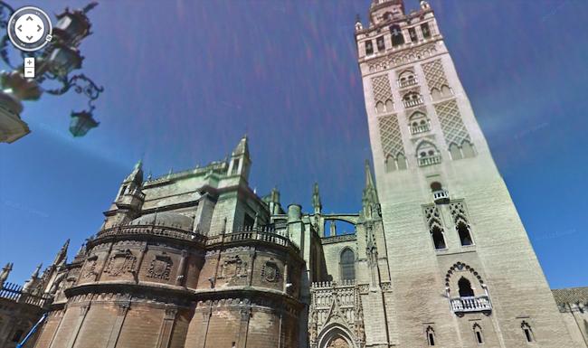
For armchair travelers looking to drop by Europe for an hour or two, Seville Cathedral (below) in southern Spain may be of interest, or how about a boat trip down the canals of Copenhagen in Denmark?
Soccer fans might want to explore Brazil’s Vila Belmiro stadium, home to the Santos team. Soccer legend Pelé spent almost his entire career here, from 1956 to 1974.
All in all it’s an impressive update, with Google seemingly determined on ensuring stay-on-the-sofa vacationers are never short of an idea or two for their next trip.
The Web company recently announced it had been gathering data from the Galapagos Island for Street View, which it plans to add to its service in the coming months.
Editors' Recommendations
- Update Google Chrome now to protect yourself from an urgent security bug
- Google’s new Chrome add-on lets you create links to specific text on a webpage
- Google’s Street View cars are helping build a giant map of global air pollution