
Can you locate India’s crashed lunar lander in this image?

The Chandrayaan-2 lander, Vikram, attempted a landing September 7th (Friday the 6th in the United States), on a small patch of lunar highland smooth plains between Simpelius N and Manzinus C craters. Unfortunately the landing was not successful and location of the spacecraft has not been announced. The scene above was captured from an LROC Quickmap fly-around of the site, image width is about 150 kilometers across the center NASA/GSFC/Arizona State University

There’s one new piece in the puzzle of the sad end to India’s Chandrayaan-2 moon lander. Last month, the Indian Space Research Organization (ISRO) attempted to land the Vikram lander on the moon but lost communication with it during the final descent. It is believed that during this time the lander flipped upside down and crashed into the lunar surface. Although the ISRO was able to locate the lander on the moon, they were not able to reestablish communications with it before its power ran out.

Now, NASA’s orbiting lunar spacecraft, the Lunar Reconnaissance Orbiter (LRO) has snapped a picture of the area where the crash is believed to have occurred. The LRO is able to take high-resolution images of the surface of the moon from orbit, and has previously spotted the crash site of the Israeli lander Beresheet and seen China’s Chang-e 4 lander exploring the far side of the moon.

A view looking down on the Vikram landing site (image acquired before the landing attempt), image width 87 kilometers (54 miles) [NASA/GSFC/Arizona State University

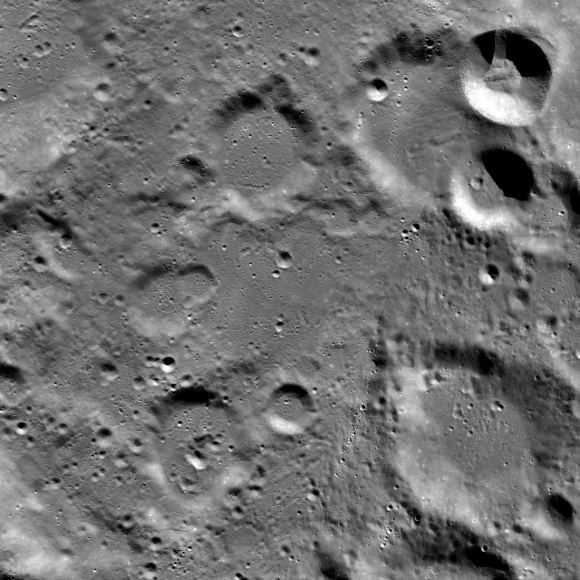
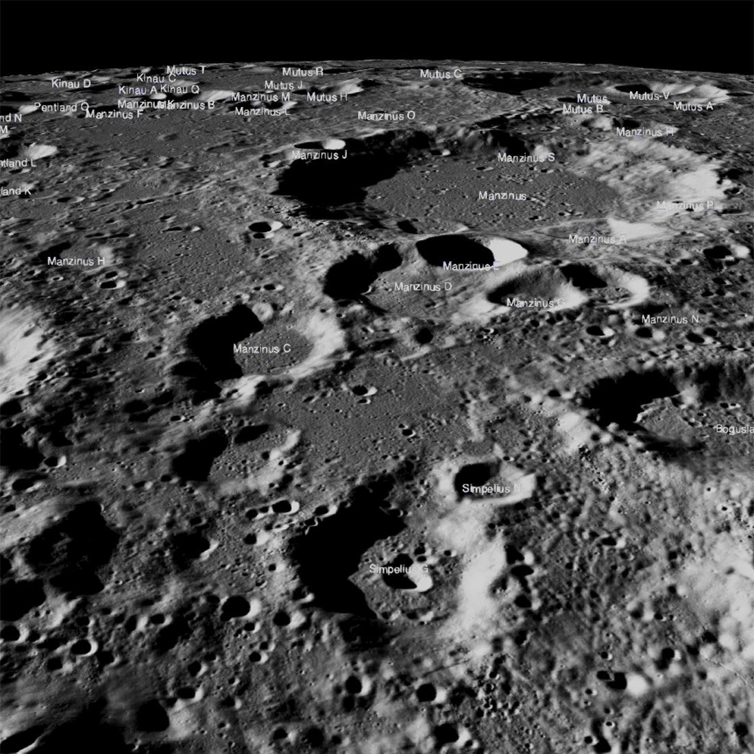
However, it’s extremely difficult to spot the Vikram crash site from the LRO image because the lander was so small. There are also many shadows in the image, which could obscure the lander’s remains. The projected landing site was between two of the craters seen above, Simpelius N and Manzinus C, which are located near to the south pole of the moon. The IRSO hasn’t shared the location of the crashed lander, but NASA believes it must be somewhere in this image.

If you fancy searching for the lander yourself you can go to the LROC website, where there is an interactive map of the moon centered on the co-ordinates at which Vikram was supposed to land. You may also want to check out the LROC’s map of the entire lunar surface, focused on the co-ordinates of the landing site: 70.8°S latitude by 23.5°E longitude.

Editors' Recommendations

Georgina Torbet
Georgina is the Digital Trends space writer, covering human space exploration, planetary science, and cosmology. She…
South Korean lunar orbiter takes gorgeous images of Earth
Photo taken on December 24 at 344 km above the moon

The moon is so hot this year, with current or future lunar missions planned from the U.S., Russia, UAE and Japan, and India. And there's also South Korea, which launched its first lunar mission in August 2022. The Korea Pathfinder Lunar Orbiter (KPLO) arrived in lunar orbit in December 2022, and it recently sent back a couple of stunning images of Earth as seen from the moon.

https://twitter.com/kari2030/status/1610097598953828354

Read more
How to watch SpaceX launch NASA’s Lunar Flashlight mission
NASA's Lunar Flashlight spacecraft.

Following a delay to its original launch schedule, SpaceX is once again preparing to launch NASA’s Lunar Flashlight satellite, as well as HAKUTO-R Mission 1 in what is the first privately led Japanese mission to attempt a lunar landing.

All being well, the Falcon 9 rocket carrying the payloads will lift off from the Kennedy Space Center in the early hours of Sunday, December 11. The launch will be streamed online as it happens, so check below for the precise details on how to watch.

Read more
NASA inks deal with SpaceX for second crewed lunar landing
Artist concept of the SpaceX Starship on the surface of the Moon.

Artist concept of the SpaceX Starship on the surface of the moon. SpaceX

NASA has inked a deal with SpaceX for a second mission to put astronauts on the lunar surface before the end of this decade.

Read more