
Abandoned Japanese island that inspired villain’s lair in Skyfall comes to Street View

hashima3The abandoned Japanese island that was used as the inspiration for the villain’s hideout in the latest Bond movie, Skyfall, has been brought to Street View in all its decrepit and dilapidated glory.

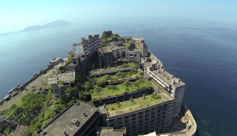
Hashima, nicknamed Battleship Island (Gunkanjima) for its shape, covers a mere 18 acres and takes 40 minutes to reach by boat from Nagasaki in the far west of Japan. The extraordinary location was home to a mining community of some 5,000 until it was abandoned in 1974 following the country’s switch to other forms of energy. The island has been left untouched since its inhabitants left almost 40 years ago, though many of the buildings are now close to collapse as nature slowly but steadily reclaims the land.

Related Videos
hashima1

Skyfall producers searching for the perfect location for Bond villain Raoul Silva’s hideout thought they’d struck gold when they set foot on Hashima. However, after spending several days there, they decided the buildings were in such poor condition that it was simply too dangerous to shoot there. Reluctant to entirely give up on the idea, they recreated part of the island back at the movie studios, using digital effects to broaden the scene.

hashima2

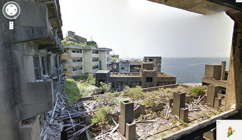
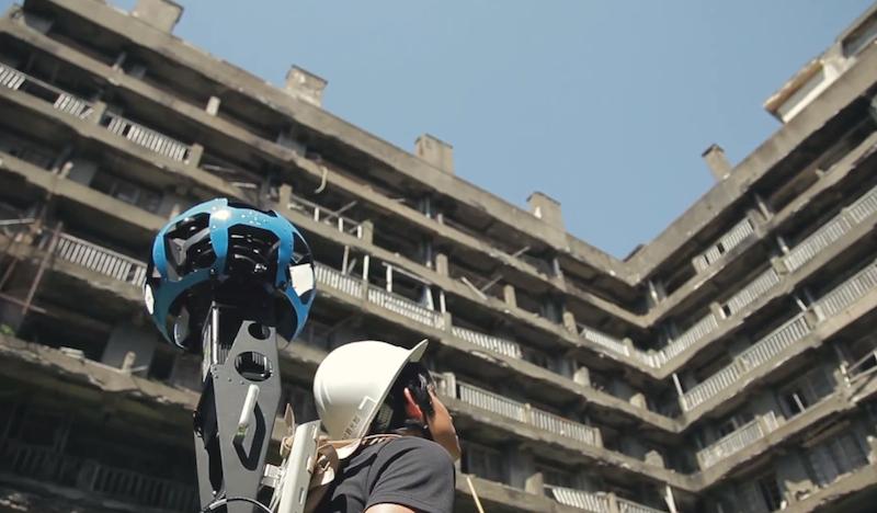
The island was opened to tourists in 2009, though trips are heavily supervised, with many areas off-limits because of the unstable structures. Take a look around with Street View, however, and you’ll gain access to parts regular tourists can’t reach. Google gathered the dramatic images recently using one of its wearable Trekker cameras, ideal for tricky locations like Hashima.

Check out the video below showing the images being captured, or head straight over to the island by clicking here.

Editors' Recommendations

Topics
The Christmas Island annual crab migration is coming to Google Street View
Christmas Ilsnad Street View

Every year, tens of millions of red crabs embark on an annual migration across Christmas Island in Australia, from their burrows in the forest to the coast, where they breed and release eggs into the sea. It’s a spectacular sight, lasting two weeks or so, and the annual event draws tourists from around the world.

For the first time ever, you’ll be able to experience this amazing natural event yourself on Google Street View in the coming year. As Google recently posted on its blog, Dr. Alasdair Grigg of Parks Australia will be recording images of this yearly trek using the Street View Trekker.

Read more
A.I. predicts how you vote by looking at where you live on Google Street View
street view ai politics 22 artificialin

Google Maps’ Street View feature is a great way to explore the world around you, but could it be revealing more about your neighborhood than you think? That's quite possible, suggests new research coming out of Stanford University. Computer science researchers there have been demonstrated how deep learning artificial intelligence can scour the images on Google Street View and draw conclusions about issues like the political leaning of a particular area — just by looking at the cars parked out on the street.

“We wanted to show that useful insight can be gained from images, the same way people do this for social networks or other textual-based data,” Timnit Gebru, one of the lead researchers on the paper, told Digital Trends. “Some of the car-politics or car-race associations were intuitive, but still surprising that we could capture from our data.”

Read more
Ditch the 3D stitch — updated algorithm means a clearer Google Street View
google street view optical flow stitch software googlestitch

Nothing quite disrupts the "being there" experience of a 360 photo like a bad stitch line. But Google Street View panoramas will soon have fewer disruptions thanks to new research by Google. On Thursday, November 9, Google Research shared a new algorithm to create more seamless stitches.

While Google says proper hardware can help minimize stitch lines, factors like parallax, or that effect where straight lines appear to curve together in the distance, can create problems for the software. A slight time difference between each photo can still create oddities where the images meet, which can pop up often since Street View Cameras are often mounted on top of moving cars. To illustrate, Google shared images of the Sydney Opera House with off-kilter architecture and a panorama of the Tower Bridge in London where the bridge doesn’t actually meet up with the other half.

Read more