
 Google developers have evidently been busy working on changes to its Earth and Maps services, rolling out a number of updates on Wednesday.
First up, Google Earth 7.1 for iOS and Android comes with a new streamlined interface – a tap in the top left of the screen now brings up quick access to more information through layers like Panoramio Photos and Wikipedia.
The free mobile app has also been updated with Street View. To enable the new feature, you simply drag the human icon in the in the top right onto the street you want to explore. The developers have worked it so that you ‘fly’ down to your chosen spot, with the imagery tilting as you near the ground before morphing smoothly (sort of) to Street View mode. The effect is actually pretty cool and offers a different experience to Maps. See what you think.
Directions have also been improved for the mobile version of Google Earth, and now enable you to visualize step-by-step transit, walking and biking directions in full 3D. You can grab the new mobile version of Earth from iTunes or Google Play now.
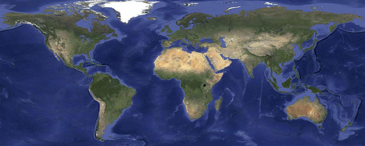
Cloudless
Rolling out on the same day are a number of changes to Maps and Earth. New satellite imagery that “virtually eliminates clouds” has been introduced, together with a whole load of new data that “offers a more comprehensive and accurate view of the texture of our planet’s landscape.”
Google’s Matt Hancher said in a blog post announcing the update that his team had recently mined a stack of data from the USGS’s and NASA’s Landsat 7 satellite, using it to create a seamless and globally-consistent image of the whole planet with a resolution of 15 meters per pixel.
Google has also worked to eliminate striped artifacts – caused by a hardware issue on the Landsat 7 satellite – that plagued some of its imagery. And as already mentioned, the clouds have gone too – the pictures below offer an example of the improved data.


Hancher said that once new data starts rolling in from the recently launched Landsat 8 satellite, we can expect to see a whole lot more high-res imagery added to Google Earth over the coming months and years.
Editors' Recommendations
- How to view Instagram without an account
- How to stop spam texts on iPhone and Android phones
- Google is launching a powerful new AI app for your Android phone
- Google just redesigned one of its biggest apps, and it’s bad
- There’s a big problem with smartphone software updates


