
Curiosity captures eerie images of lonely Martian landscape

This image was taken by NAV_RIGHT_B onboard NASA’s Mars rover Curiosity on Sol 2580 NASA/JPL-Caltech

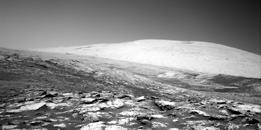
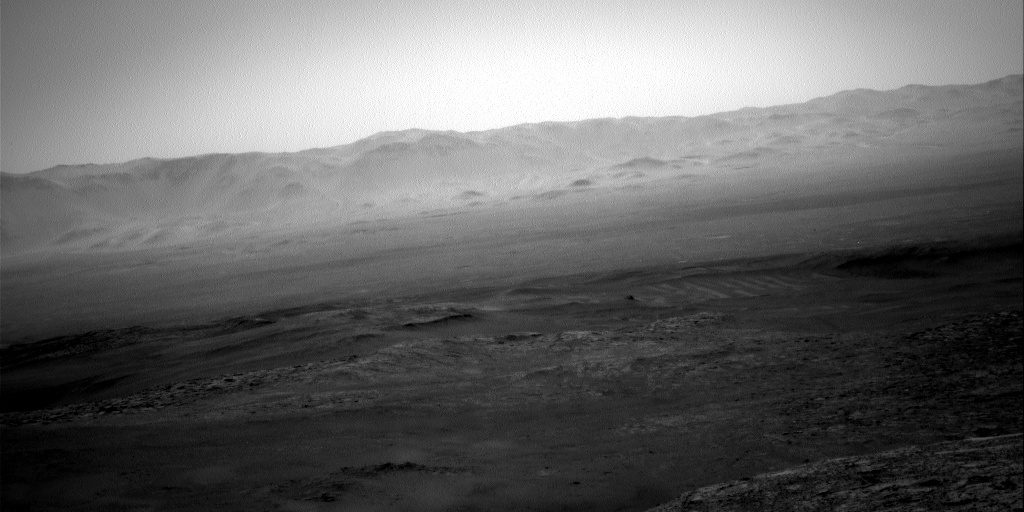
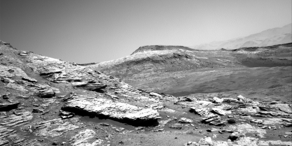
NASA’s Curiosity rover is continuing its lonely exploration of Mars, and has captured these beautiful but haunting views of the deserted Martian landscape.

These images were snapped this week and show the desolate outlook across the Gale Crater. You can view a regularly updated feed of the raw images captured by Curiosity on NASA’s website, with information about when and where each image was taken and which of Curiosity’s multiple cameras took it.

Curiosity has a total of seventeen cameras on board, including the Remote Micro Imager which is part of the Chemistry and Camera suite (aka ChemCam), two black and white navigation cameras on both left and right, two color cameras on the mast (aka Mastcams), one on the end of the robotic arm, and nine more cameras mounted to the rover’s body for functions like hazard avoidance and landing assistance. The photos shown here were taken by the black and white navigation cameras.

This image was taken by NAV_RIGHT_B onboard NASA’s Mars rover Curiosity on Sol 2580 NASA/JPL-Caltech

Curiosity is currently studying an area of the Gale Crater called Mount Sharp, a mountain rising 5.5 km (3.4 miles) above the floor of the crater. For reference, that’s roughly the same height as Mount Kilimanjaro in Tanzania, the highest mountain in Africa. Curiosity is moving around the base of the mountain, looking at the layers of rock which can give clues to changes in the Martian environment over time.

Over the next few years, Curiosity will wend its way up the mountain toward areas of higher elevation, moving through an area called the sulfate unit where scans from orbit have detected sulfate minerals. This indicates that there was once ancient water in the area which either dried out or became more acidic over time.

This image was taken by NAV_RIGHT_B onboard NASA’s Mars rover Curiosity on Sol 2580 Image used with permission by copyright holder

Curiosity will also be exploring a region called the Gediz Vallis channel, a gorge where an ancient river used to run. This gorge formed later than the sulfate unit and can tell us more about the history of water on Mars.

For now, the rover is exploring a region called the Central Butte, where rocks have been eroded to reveal layers that are believed to have formed between 3.5 billion and 3.8 billion years ago.

Editors' Recommendations

Georgina Torbet
Georgina is the Digital Trends space writer, covering human space exploration, planetary science, and cosmology. She…
Check out this eerie Mars sunset captured by NASA’s Perseverance rover
A sunset on Mars.

NASA’s Perseverance rover recently took some time out of its busy Mars exploration to capture a striking image of the setting sun.

Snapped earlier this month and posted by the space agency in recent days, the image (below) shows an eerie glow behind Mars’ rocky landscape.

Read more
Curiosity investigates how to keep Mars explorers safe from radiation
NASA’s Curiosity Mars rover used its Mars Hand Lens Imager, or MAHLI, to take this selfie at the “Quela” drilling location in the “Murray Buttes” area on lower Mount Sharp between Sept. 17 and 18, 2016.

One of the biggest dangers to humans when planning a mission to Mars is something invisible: Radiation. Without the Earth's magnetosphere to protect them, astronauts would be bombarded with radiation while visiting Mars. And although living on the red planet for a few months probably wouldn't be immediately fatal, it would increase lifetime risks for illnesses like cancer considerably.

There are plans like using shielding or medication to protect future astronauts visiting Mars, but there's still a huge amount we don't know about the radiation risks there. To address these unknowns, NASA's Curiosity rover is armed with a radiation detector and is performing experiments to see how we could protect astronauts against dangerous radiation particles.

Read more
Go on a ‘Grand Tour’ of the outer solar system with these Hubble images
The NASA/ESA Hubble Space Telescope has completed its annual grand tour of the outer Solar System for 2021. This is the realm of the giant planets — Jupiter, Saturn, Uranus, and Neptune — extending as far as 30 times the distance between Earth and the Sun. Unlike the rocky terrestrial planets like Earth and Mars that huddle close to the Sun’s warmth, these far-flung worlds are mostly composed of chilly gaseous soups of hydrogen, helium, ammonia, and methane around a packed, intensely hot, compact core. Note: The planets are not shown to scale in this image.

The planets in our solar system aren't static. Like Earth, the other planets also experience seasonal variations with atmospheric changes occurring throughout the year. That's why each year the Hubble Space Telescope snaps images of the outer planets of our solar system -- Jupiter, Saturn, Uranus, and Neptune -- so astronomers can see how they are changing over time.

The NASA/ESA Hubble Space Telescope has completed its annual grand tour of the outer Solar System for 2021. Note: The planets are not shown to scale in this image. Image used with permission by copyright holder

Read more