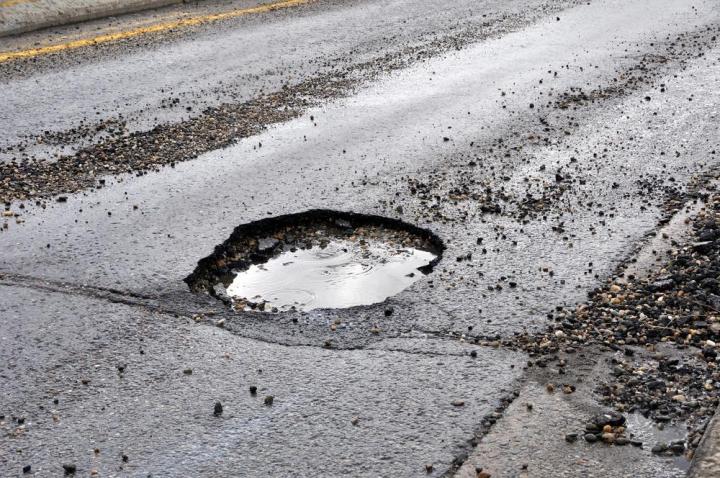
Part of the solution is swifter response times by state and city road crews, but potholes’ unpredictable nature can make tracking them a challenge — most municipalities rely on paper reports to locate holes that need fixing. If a patent filed by Google last week is any indication, though, a faster and more accurate method of mapping potholes might be just around the corner.
Google’s newly-granted patent describes software that uses two sensors — GPS and a vertical accelerometer — to automatically document nasty bumps in the road. When a vehicle drives over a pothole, the motion sensor records the severity of the jolt, tags it with the car’s geographic location, and uploads it to the cloud. Specialized software can then eliminate anomalies, cancel out duplicate reports, and generate an individualized “health report” for roads, so to speak.
Google’s proposed system isn’t the first attempt at crowdsourcing pothole locations. Street Bump, a program operated by the city of Boston, is an app that uploads accelerometer and GPS smartphone data to a centralized server and alerts drivers to the locations of unfixed bumps. But Street Bump, unlike Google’s system, requires manual interaction — trips have to be logged individually.
The use cases for continuous pothole monitoring aren’t difficult to imagine — a future version of Google Maps could warn drivers of particularly uneven routes — but cities and states in particular stand to benefit from an automated, up-to-date database of damaged roads. Delayed repairs are often expensive — failure to spend $1 in road repair can result in $7 of cost five years later — and empirical data might just help convince skeptics to address the U.S.’s chronic infrastructure shortfall. (The American Society of Civil Engineers puts the cost of fixing the country’s highways and bridges at $2.7 trillion and rising).
Google’s long-term play, though, is likely for its driverless cars. A comfortable ride is one of the longstanding hopes for self-driving vehicles, and one capable of intelligently navigating around bumpy roads would no doubt deliver. Patents aren’t always indicative of future products, but don’t be surprised to see pothole-sensing tech in a future Google car.