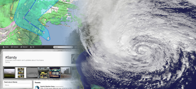
In October 2012, Hurricane Sandy was classified as a large low-pressure system over the south waters of Cuba. Five days later, it was recorded as one of the largest hurricanes in history, charging up the east coast of the United States and leaving people stranded and without power. The government was hard-pressed to decide how to best send out its cleaning crews — what areas were most in need? Who required emergency supplies and services?
Inaccurate mapping during Superstorm Sandy and Hurricane Katrina delayed hurricane response by weeks and months. The U.S. Federal Emergency Management Agency (FEMA) typically observes the storm itself, the local geography in its path, and infrastructure to form models. It then puts planes in the air to add details to the maps. The agency came under criticism for its slow response to Katrina victims.
Yuru Kryvasheyeu, a computational physicist, led a team to study real-time events through tweets and then create a map. First, the team had to acquire the data. This proved tricky, as researchers are hesitant to trigger legal action by using data from companies like Twitter, which opened its full archive to academics in 2014. Kryvasheyeu navigated this hurdle by buying just a subset of data from a third party company that collects, processes, and resells data from Twitter. The team narrowed down its search all the tweets in the world from between October 15 and November 12, 2012, which includes the time just before the hurricane hit and some days after it dissipated. Further refinement was acheived by setting the search to tweets that include words like “hurricane,” “Sandy,” “frankenstorm,” and “flooding.”
Many tweets did include the user’s location, but for those that did not, the team analyzed those accounts and message contents to get the missing information. Researchers mapped out nearly 10 million tweets from over two million accounts.
It was discovered that the closer people were to the hurricane, the more they tweeted about it. So while the results weren’t completely random, they must also be taken with a grain of salt. How much does the number of tweets reflect on the actual destruction from the event? Local media thrives on instilling fear in its small audience, and this could have added to the increase in social activity. To mitigate this, researchers turned to FEMA and the state governments of New York and New Jersey to get an official rundown of the damage.
When compared, the results of the Twitter study showed promise. The more actual damage sustained by Sandy in a local area (as measured by the cost of repairs), the more its residents tweeted. Surprisingly, Twitter itself was a bit more accurate than FEMA when it came to predicting the location and degree of damage from the storm.
We must still exercise caution, as social media in general has its own limitations and problems with accurate data. “Twitterbots” are programs that repeat the most popular tweets and reply to legitimate tweets, and these must be taken into account. However, Urbano Franca, a health researcher at Harvard Medical School says that the researchers here “seem to have though of most, if not all, issues and potential loopholes.” He suggests that other social media platforms such as Facebook, be studied next, though getting to that data might not be easy.