
Could there be underground lakes on Mars’s southern pole?

The bright white region of this image shows the icy cap that covers Mars’ south pole, composed of frozen water and frozen carbon dioxide. ESA’s Mars Express imaged this area of Mars on Dec. 17, 2012, in infrared, green and blue light, using its High Resolution Stereo Camera.
The bright white region of this image shows the icy cap that covers Mars’ south pole, composed of frozen water and frozen carbon dioxide. ESA’s Mars Express imaged this area of Mars on Dec. 17, 2012, in infrared, green, and blue light, using its High Resolution Stereo Camera. ESA/DLR/FU Berlin/Bill Dunford

The question of how to access water on Mars is a big one if we eventually want to send a crewed mission there. As far as we can tell, Mars doesn’t have liquid water on its surface now, but it does have large amounts of ice at its poles as well as subsurface ice in other regions. Locating exactly where this subsurface ice is and how accessible it is is a major question to be answered by the upcoming Mars Ice Mapper mission.

Recommended Videos

Now, a new study using data from an orbiter suggests that there could be large subsurface ‘lakes’ on Mars, although how there could be liquid water in such a cold environment remains unclear.

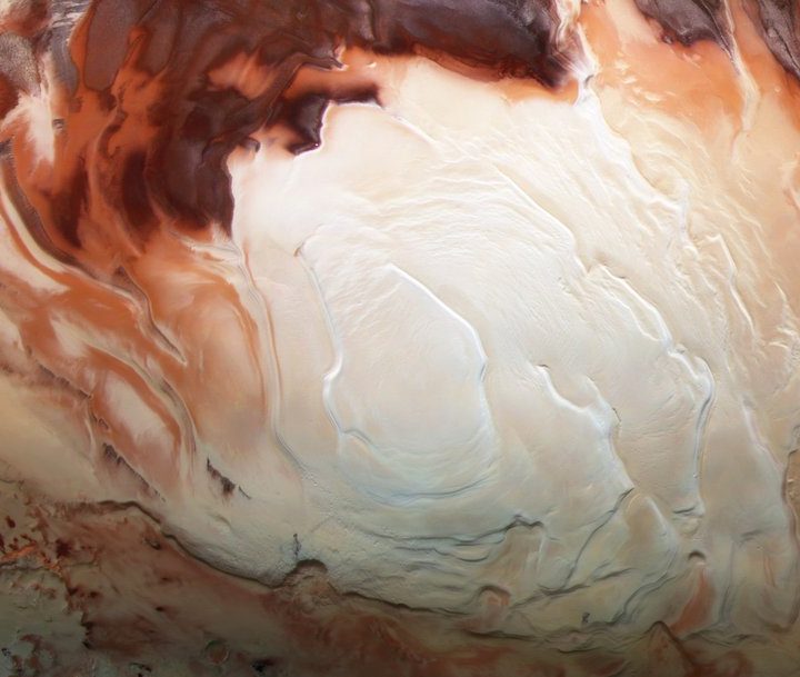
Researchers used data from Mars Express, the European Space Agency’s orbiter which uses radar as well as a high-definition camera to image the planet. The radar data shows signals around the south pole which suggests the presence of underground lakes. This concept was first floated in 2018, when different researchers used data from the same orbiter to locate the first lake. This new study has found dozens of similar signals.

However, Mars gets very cold and this far south, it is thought to be too cold for water to remain in its liquid form. So it’s not clear how to explain the radar signals.

“We’re not certain whether these signals are liquid water or not, but they appear to be much more widespread than what the original paper found,” said Jeffrey Plaut of JPL, co-principal investigator of the orbiter’s MARSIS (Mars Advanced Radar for Subsurface and Ionospheric Sounding) instrument. “Either liquid water is common beneath Mars’ south pole or these signals are indicative of something else.”

Some of the signals found less than a mile from the surface, where the estimated temperature would be minus 81 degrees Fahrenheit (minus 63 degrees Celsius). At that temperature, the water would be frozen even if it contained salts which lower its freezing temperature. There is a possibility that underground volcanic activity could raise the temperature enough to keep water liquid, although this kind of activity hasn’t yet been identified in the area.

“They found that it would take double the estimated Martian geothermal heat flow to keep this water liquid,” said Aditya Khuller, co-author of the paper. “One possible way to get this amount of heat is through volcanism. However, we haven’t really seen any strong evidence for recent volcanism at the south pole, so it seems unlikely that volcanic activity would allow subsurface liquid water to be present throughout this region.”

The research is published in the journal Geophysical Research Letters.

Georgina Torbet
Georgina has been the space writer at Digital Trends space writer for six years, covering human space exploration, planetary…
Take a flight over Mars’ Ares Vallis in a new video from Mars Express
mars ares vallis flyover screenshot 2024 11 30 234209

A new video shows what it would be like to cruise over the surface of Mars, zooming in to the planet from orbit and into a channel called the Ares Vallis. Created from data taken by the European Space Agency's (ESA) Mars Express mission, it shows the region where NASA's Pathfinder mission landed in 1997.

Fly around Ares Vallis on Mars

Read more
Check out this incredible panorama of Mars taken by Curiosity
NASA’s Curiosity captured this panorama using its Mastcam while heading west away from Gediz Vallis channel on Nov. 2, 2024, the 4,352nd Martian day, or sol, of the mission. The Mars rover’s tracks across the rocky terrain are visible at right.

The Curiosity rover has been on Mars since 2012, and in that time it has driven more than 20 miles -- which might not sound like a lot, but is a long distance for a rover traveling at slow, careful speeds that are somewhat less than the average garden snail. The rover has now reached the end of an area it has been exploring for the past year -- a channel called Gediz Vallis -- but before it moved on, the rover snapped a series of images of the area, which you can explore in this NASA panorama:

Key features are marked on the panorama, including the route along which the rover will exit the channel, as well as the tracks that lead back to show the direction the rover came in. In the far distance you can see the rim of the Gale Crater, which is the larger area that Curiosity is exploring, and the Pinnacle Ridge, which is formed from a mound of debris that scientists are still studying.

Read more
Elon Musk shares new target date for Starship voyage to Mars
elon musk stylized image

SpaceX is aiming to launch “about five” uncrewed Starship voyages to Mars in two years’ time, according to a post on X (formerly Twitter) by CEO Elon Musk on Sunday.

Musk said that if the uncrewed missions land safely on the red planet, then the first crewed mission could take place as early as 2028, but he added that “if we encounter challenges, then the crewed missions will be postponed another two years” due to the alignment of Earth and Mars that makes such journeys possible. He continued: “We want to enable anyone who wants to be a space traveler to go to Mars! That means you or your family or friends -- anyone who dreams of great adventure. Eventually, there will be thousands of Starships going to Mars and it will a glorious sight to see! Can you imagine? Wow.”

Read more