

We all get cabin fever now and then, and there’s nothing quite like a hike in the woods or a camping trip to shed the desk-job blues. It’s time to get outdoors and go on an adventure. Thankfully, we’ve been scouring the iOS and Android app stores in search of handy hiking aids, camping help, and adventure apps — we’ve grouped it all here in the best hiking apps. If you’re heading out into the wild and leaving the comforts of the modern world behind, just make sure you install these apps first — some of which are features on our picks for the best iPhone and Android apps. Also, don’t forget your smartphone!
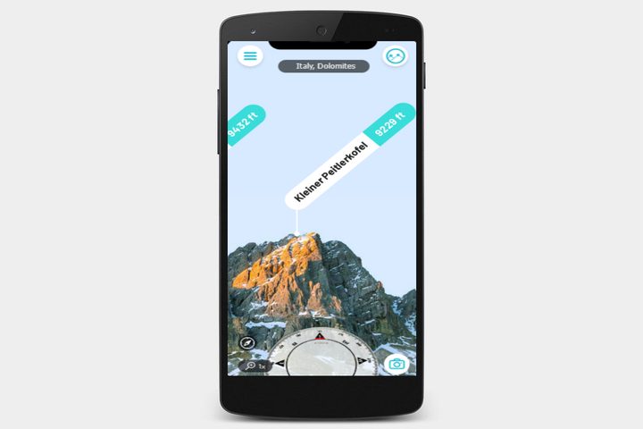
PeakVisor ($4)
Taking a moment to pause and catch your breath on a hike, you gaze out at the mountain on the horizon.
“Look at that,” you say, smiling and turning to your friend. “Isn’t Mount Hood beautiful?”
“Pretty sure that’s Mount Jefferson,” your friend replies. Your smile remains, frozen in rictus, but your eyes sharpen.
“No, it’s definitely Hood.”
“No, it’s Jefferson.”
“Hood!
“Jefferson!”
Before long, you’re tussling, each trying to throw the other off the side of a cliff for having the audacity to be so wrong. If only you had PeakVisor, a lovely little app that uses your phone’s camera and the power of augmented reality to identify any mountain you aim the camera at. You can download maps for specific regions you plan to hike, so you can use the app even when you have no connection.
Yonder
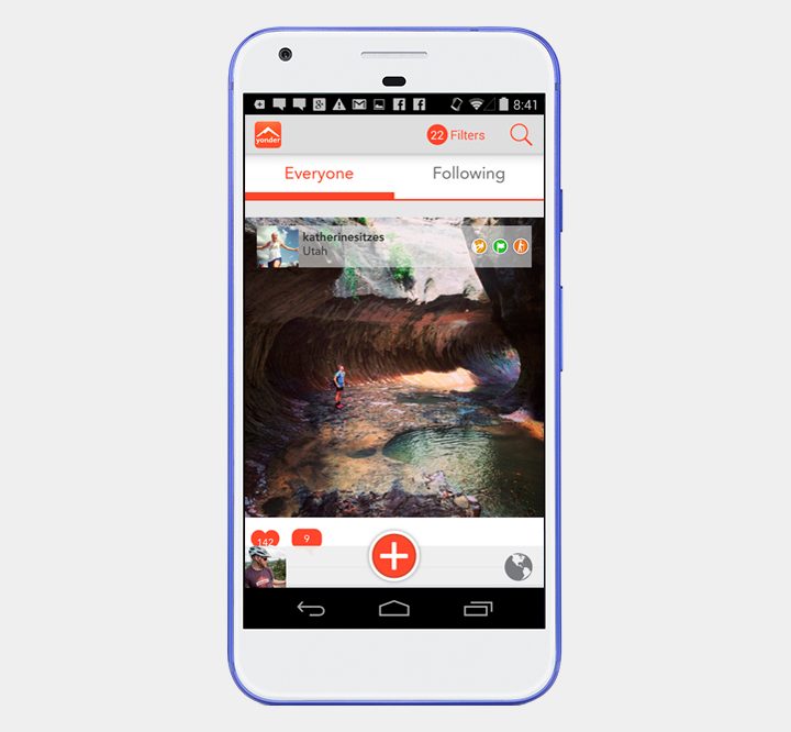
If you’re a lover of the outdoors, you may want to discuss your adventures with other outdoor junkies. Yonder allows you to easily share your experiences when it comes to hiking, camping, and biking. It acts like a social media network for those that enjoy the great outdoors. Yonder isn’t just a social app, however. The other half of the app is aimed at exploration, and such being the case, it allows you to see experiences close to you. You can also view shared images, which is helpful when you’re searching for something to do.
Cairn
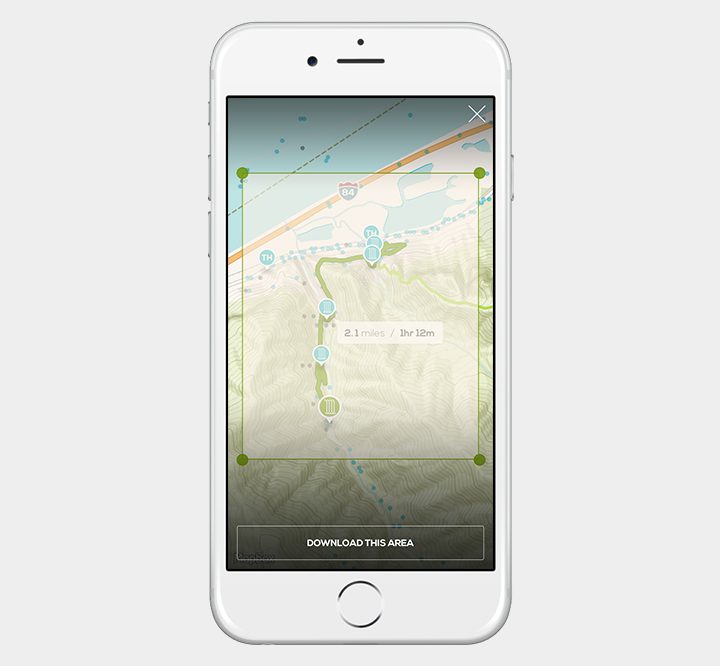
Safety, when you’re hiking, is paramount, but it’s the last thing you want to worry about on the trail. Fortunately, Cairn helps you stay out of harm’s way, and get help should you need it. The app crowdsources cell coverage areas, so you know where you can expect service before you set foot on the trail. It also ties into your GPS, so friends or loved ones can keep tabs on your location when you’re out and about. You can set up the app to automatically notify specific contacts when you’re overdue, and even download a collection of free maps and trails with statistics for thousands of routes in the United States and United Kingdom. Cairn is iOS-only at the moment, but an Android version is on the way.
Geocaching
Want more of a challenge when hiking? Geocaching is basically a modern day treasure hunt, one that requires players to hide small items and tokens before posting their GPS coordinates in the Geocaching app. The app features upwards of 2 million treasures, and utilizes your phone’s GPS to help you find them. It even provides recommendations and tips for beginners.
Leafsnap
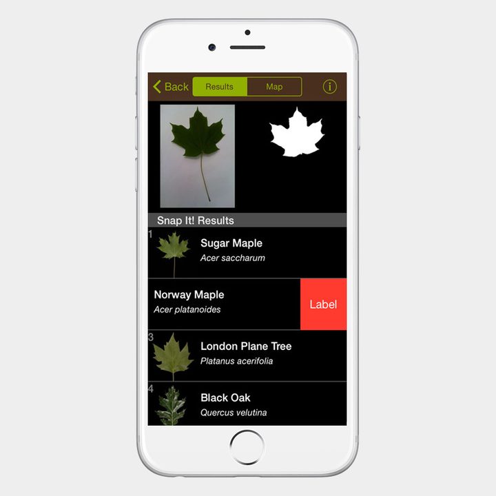
Maybe birds aren’t your thing — maybe you’re more into flora than fauna. If that’s the case, Leafsnap is the app for you. Leafsnap is a joint project between Columbia University, the University of Maryland, and the Smithsonian Institution. It uses visual recognition technology to help you identify what species of tree a leaf is from — just take a photo and the app will tell you what you’re looking at. The app doesn’t just identify leaves, though. It also offers hi-resolution photos of bark, fruit, and flowers, which can help in the identification process.
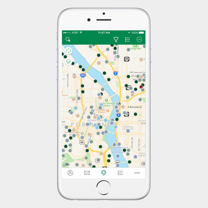
AllTrails
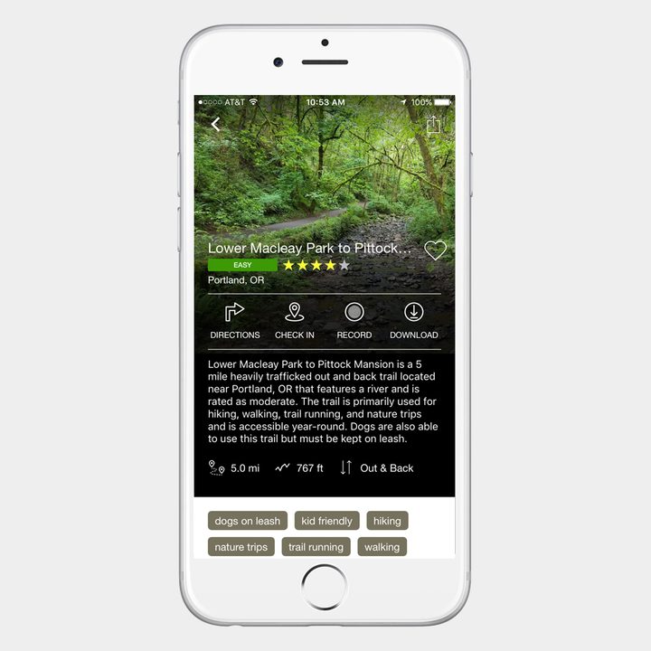
With 50,000 trail guides in the U.S. and Canada alone, it’s not too difficult to work out why the AllTrails app has more than 1.5 million users. It’s an easy way to find trails near you, whether you want a gentle hike, a bone-rattling mountain bike track, or a great spot for some fly-fishing. You can create your own trails with GPS tracking, photos, and text, and save them for later or share them with others. If you are willing to splash out $30 per year for a membership, then you get the pro version, which takes advantage of a partnership with National Geographic Maps, and gives you the ability to print and edit maps. There are also events, such as the World Elevation Challenge, which lets participants to compete and track their progress in real-time as they scale Matterhorn, Kilimanjaro, Mount McKinley, and Everest.
Mountain Hub
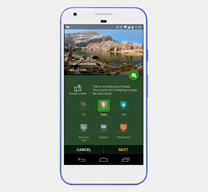
With Mountain Hub, you can look to your fellow hikers, skiers, hunters, climbers, and so on for updates on terrain and weather. The app pulls together resources from a wealth of contributors to explain trail data in a practical, concise way. Mountain Hub is free to download, but there’s a premium version that runs $3 a month or $25 a year that adds a variety of features. Pro users can mark hazards and points of interest on their way, for instance, and download topographic and aerial maps with a variety of layers for offline viewing.
MapMyHike GPS Hiking
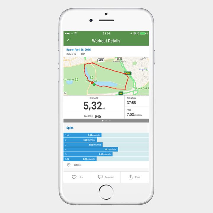
Looking for an app to track your hike or cycle? This one will provide you with detailed feedback on your route, your average pace, distance covered, calories burned, and a whole lot more. It’s geared towards workouts, but it has a number of features that make it ideal for anyone looking to record hiking routes and share them easily. You can also find popular local routes and compete with others to record the best times. If you sign up for the premium version at $6 per month, there’s a live tracking feature that lets you keep tabs on your hiking buddies in real time, heart rate analysis, audio coaching, and route recommendations.
MotionX GPS ($2)
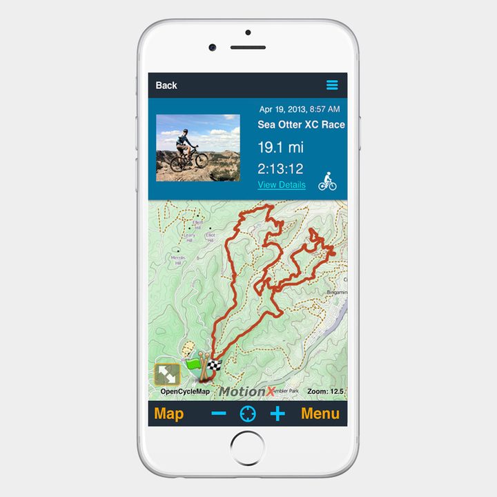
For iOS, we recommend the MotionX GPS app. It offers a good selection of free topographical maps and marine charts. It also supports GPS navigation, without the need for cell service, but you will need to splash out on in-app purchases if you want to increase your GPS waypoint limit. GPS will work without cellular service, but you need to download maps and other data for where you’re hiking in advance of your trip.
Audubon Birds Pro
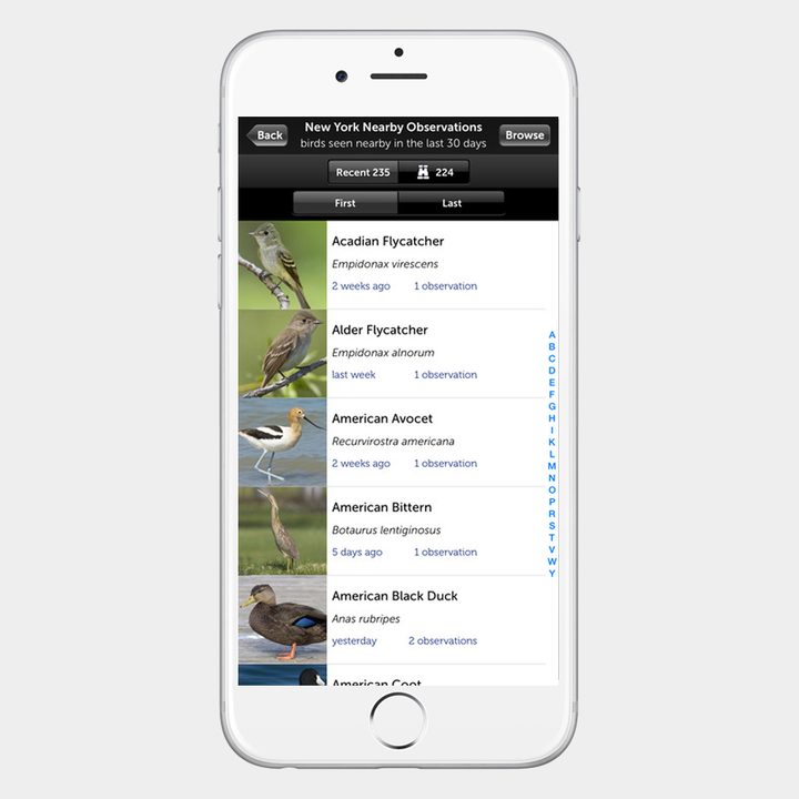
If you’re a bit of a twitcher pursuing a list, or you’d just like to learn to identify the birds that you see when you’re out hiking, this app will help. It includes the current AOU Checklist of North American Birds, and there are 808 species covered with photos and detailed descriptions. You can listen to the sounds that different birds make to help you identify songs and calls. You’ll even find migratory maps and updated sightings drawn from the database at the Cornell Laboratory of Ornithology. It combines an accessible guide with bird alerts, and it’s great value for money on Android. If you do like it, then check out Audubon’s other apps covering everything from trees to insects.
Gaia ($20)
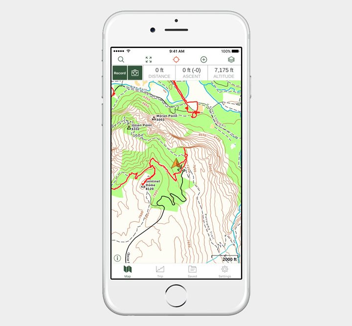
Avid hikers will love Gaia’s detailed topographic, satellite, and road maps, as well as its extensive feature set. Users can record their tracks in real time using GPS, mark waypoints, and snap geo-tagged photos. With the app’s built-in search function, you can also explore Gaia’s database of natural parks and trails. The app automatically backs up all your data and syncs it between multiple devices, and the iOS version saw a comprehensive update in May, which added a custom interface for iPad that allows you to easily plot your expedition before you leave home base. While the cost for all that functionality isn’t cheap — $20, to be exact — the feature set is unparalleled, and explorers and professionals alike have given Gaia glowing reviews.
SAS Survival Guide ($6)
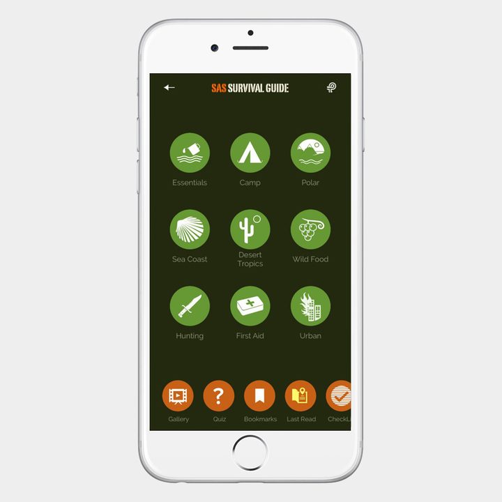
You’ll see various recommendations for military survival guides online (including the free Army Survival Guide for Android), but if you want something truly comprehensive that could save your life, you should opt for the SAS Survival Guide. The Special Air Service is a regiment of the British Army and widely regarded as one of the toughest fighting forces on the planet. This app was written by a former SAS soldier and instructor and it combines more than 400 pages of text with videos, photos, Morse code and compass devices, comprehensive first aid, and a quiz to test your knowledge. Not only is the content top quality, but the app is well designed and it’s easy to use as a reference guide.
Chimani National Parks
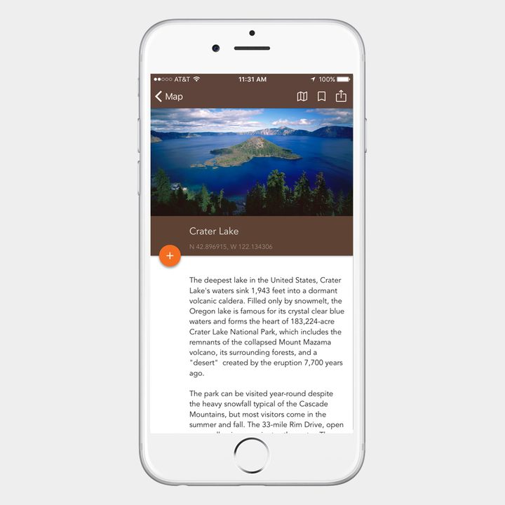
There are 59 National Parks in the United States, and this app provides useful information, up to date news, and photos of all of them. This master app gives you a map of their locations and a general overview, but you’ll find that Chimani offers free individual apps for many of the top parks, from Acadia, to Yosemite, to the Grand Canyon. These individual apps include audio tours, hiking trails, points of interest, offline GPS navigation support, and a host of additional guides for everything from the best scenic spots, to Ranger-led events. This is a great app for planning your trip and making the most of your chosen National Park when you get there.
Camp Finder ($3)
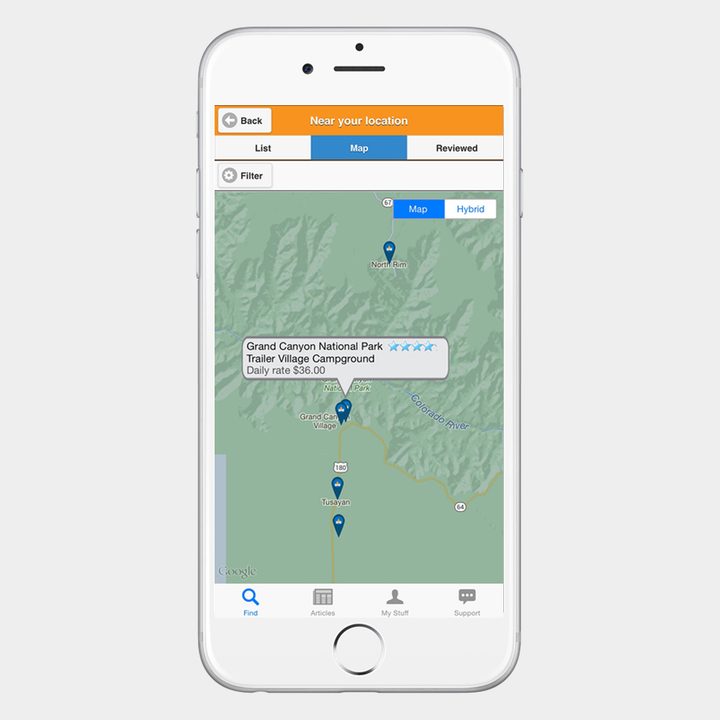
You can guess what this app does from the name. It lists over 17,000 campgrounds and RV parks all across the U.S. so that you can find an option near you. You can filter the results to find destinations offering the amenities, club discounts, policies, or activities that you specifically want. The app draws data from the popular CampingRoadTrip.com website and that means you get detailed and up to date information, photos, and reviews for each campsite. It integrates with Google Maps for easy navigation to your chosen destination and you can save a record of your favorite campsites for future reference. On Android the app costs $3, but iOS users will need to fork out an extra $1 for this app.
Animated Knots ($5)
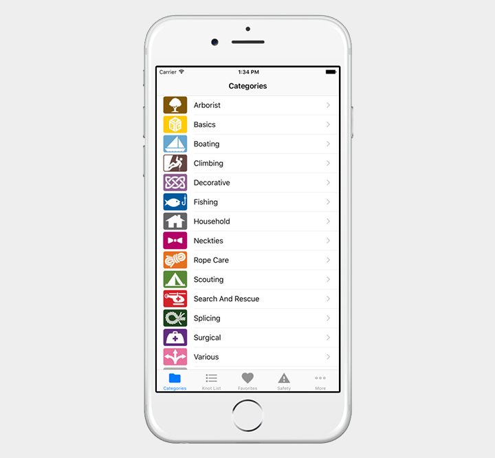
Here’s a useful app that does exactly what it says and nothing more. Knot tying is an art only true explorers have mastered, and thanks to Animated Knots, you can too. The app provides step-by-step instructions for dealing with a variety of knots, complete with photo animations that can be paused so you can follow along with each frame. Each knot also has an associated description, complete with a list of uses, as well as alternatives, strengths, and weaknesses. You can even favorite the ones you use most often.
Sky Map or Star Walk ($3)

There are few things more enjoyable, after a day’s hiking, than sitting back and gazing up at the night sky. When you’re far enough out of the city, the stars are so much easier to see, and these apps can help. Once again, there isn’t a great app for all platforms, so we’ve found an option for each one. Android users are lucky, because the free Sky Map app is really excellent. You can find the positions of the stars and planets by holding your smartphone up to the sky. You’ll also see the constellations marked, and you can even time travel to see the difference in years gone by.
You don’t need to worry if you’re using iOS, however, because Star Walk is pretty special. It marks stars, planets, satellites, and constellations, along with a night mode that’s easy on the eyes, and a time machine function to see what the sky used to look like. You’ll also find a community of star gazers, info on celestial events, and some stunning photos in this app.