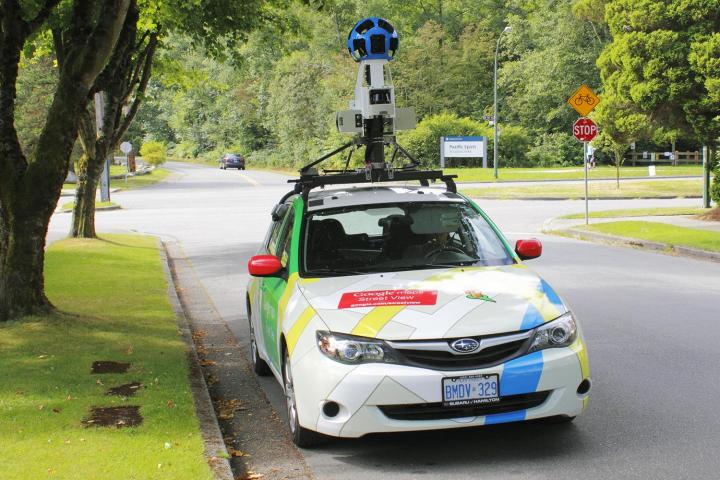
Google Street View will be taking stock of more than streets, neighborhoods, and houses in the next month or so. Rather, beginning in July, two Google Street View cars will be tasked with the important responsibility of monitoring the air quality in London. The two vehicles will be driving around the U.K. capital’s streets with sensors that take air quality measurements every 30 meters (that is about 98 feet) in order to map out and monitor pollution (or lack thereof) in the city.
Google has leveraged its Street View vehicles for similar purposes previously. About three years ago, sensors from Aclima were attached to the cars in order to map air quality in San Francisco.
London will also be affixing a total of 100 sensors to lampposts and buildings in so-called “pollution blackspots” — that is, areas with air quality that is particularly dangerous. Sensors will also be located in “sensitive locations” throughout the city, TechCrunch reports. With the combination of the two Street View cars and these additional pieces of hardware, London mayor Sadiq Khan says that the city has built “the most sophisticated [air quality monitoring network] in the world.”
The hope is that the project, which is currently slated to last an entire year, will generate hyperlocal data in order to effect change when it comes to policy. Indeed, Khan has noted that resolving air pollution is one of his biggest goals as London’s leaders.
The air monitoring initiative isn’t just being tackled by the city of London and Google; the project also has help from the Environmental Defense Fund Europe, in partnership with Air Monitors, Google Earth Outreach, Cambridge Environmental Research Consultants, University of Cambridge, National Physical Laboratory, and the Environmental Defense Fund team in the United States. In addition, King’s College London will be taking on a related study focused specifically on schools.
Once results are available from the research, they will be shared with the members of the C40 Cities network, which actually involves 90 cities around the world and focuses on climate change. Ultimately, this study could help to improve air quality for hundreds of millions of city residents the world over.
Editors' Recommendations
- Google is bringing Chrome browser to cars, even more EV features to Maps
- Are you immortalized on Google Street View? It’s easy to find out
- Amazon’s air quality sensor can tell you when indoor air is dirty
- Google deploys a Jaguar I-Pace as its first all-electric Street View car
- Airthings View Plus monitors air for particulate matter invisible to the eye