
Sentinel-6 spacecraft becomes official ocean-monitoring satellite

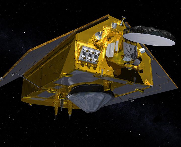
We have a new tool for monitoring Earth’s oceans: The Sentinel-6 Michael Freilich spacecraft, which has taken over from its predecessor to become the official satellite for measuring global sea levels. It took over its new role on Tuesday, March 22, and will play an important role in monitoring climate change.

The satellite, which is a joint project between the European Space Agency (ESA) and NASA, was launched in November 2020 and has been collecting initial data since then. Once engineers were confident its instruments were calibrated and accurate, it took over official sea level monitoring from the Jason-3 satellite that was launched in 2016.

Illustration showing the front of the Sentinel-6 Michael Freilich spacecraft in orbit above Earth with its deployable solar panels extended.
This illustration shows the front of the Sentinel-6 Michael Freilich spacecraft in orbit above Earth with its deployable solar panels extended. As the world’s latest ocean-monitoring satellite, it is launching on Nov. 10, 2020, to collect the most accurate data yet on global sea level and how our oceans are rising in response to climate change. NASA/JPL-Caltech

“These missions, of which Sentinel-6 Michael Freilich is the latest, are the gold standard when it comes to sea level measurements, which are critical for understanding and monitoring climate change,” said Josh Willis, Sentinel-6 Michael Freilich project scientist at NASA’s Jet Propulsion Laboratory, in a statement. “We can’t lose track of how much sea level has gone up because if we do, it’s hard to predict what’s going to happen in the decades to come.”

This satellite is the first of a pair, with its companion Sentinel-6B set to launch in 2025. Together, they will take long-term records of rising sea levels, which will provide information about the rate of global climate change. In addition, the satellites will also monitor other factors like looking at how water vapor and temperature vary throughout the atmosphere.

“The unprecedented accuracy of the sea level measurements provided by this mission ensures not only the continuity of a 30-year data record, but allows improving our understanding of climate change and the impact of rising seas on coastal areas and communities,” said Julia Figa Saldana, ocean altimetry program manager at the European Organisation for the Exploitation of Meteorological Satellites (EUMETSAT).

Georgina Torbet
Georgina is the Digital Trends space writer, covering human space exploration, planetary science, and cosmology. She…
See the first image of Earth from a new weather-monitoring satellite
First image of the full Earth disc from the Meteosat Third Generation Imager. The first image from Meteosat Third Generation – Imager 1 (MTG-I1) reveals a level of detail about the weather over Europe and Africa not previously possible from 36 000 km above Earth. The higher-resolution images provided by the instruments on board give weather forecasters more information about the clouds cloaking much of Europe and visible in the equatorial region of Africa and the Atlantic Ocean. Sand and sediment in the waters off Italy are also visible, as well as dust or smog being carried from south Asia. This degree of detail is not possible from the instruments on the Meteosat Second Generation satellites. The image was captured at 11:50 UTC on 18 March 2023 by the Flexible Combined Imager on MTG-I1.

A recently launched weather satellite has sent back its first image of Earth, showing our planet in gorgeous detail. The European Meteosat Third Generation Imager-1 was launched in December of last year with the aim of monitoring weather conditions across Europe and Africa, and it took this image from its location 22,000 miles above the Earth's surface.

The image was taken using the high-resolution Flexible Combined Imager instrument in March 2023, showing the areas of cloud and clear skies that can be seen over the Atlantic Ocean, as well as the European and African land masses.

Read more
How NASA’s astronaut class of 1978 changed the face of space exploration
Sally Ride NASA

When you look back on the long history of crewed spaceflight, one group stands out for its radical challenge to the conventional wisdom of who could become an astronaut. NASA's astronaut class of 1978 saw not only its first women and people of color working as astronauts such as Sally Ride and Guy Bluford, but also the first Asian American astronaut, El Onizuka, the first Jewish American astronaut, Judy Resnik, and the first LGBT astronaut, once again Sally Ride.

A new book, The New Guys: The Historic Class of Astronauts That Broke Barriers and Changed the Face of Space Travel, chronicles the story of this class and its impact on both NASA and the wider world’s perceptions of who could be an astronaut. We spoke to the author, Meredith Bagby, about this remarkable group of people and how they changed the face of human spaceflight.
Breaking the mold
Throughout the 50s and 60s, NASA almost exclusively chose fighter pilots for its early human spaceflight program, Project Mercury. That meant that not only were astronaut groups like the famous Mercury Seven entirely composed of white men, but they also came from very similar military backgrounds.

Read more
SpaceX Crew-6 astronauts arrive safely at space station
The space station crew all together following the arrival of SpaceX's Crew-6 in March 2023.

SpaceX's four Crew-6 members have safely boarded the International Space Station (ISS) following a voyage that lasted about 27 hours.

NASA astronauts Stephen Bowen and Warren Hoburg, United Arab Emirates astronaut Sultan Al Neyadi, and Roscosmos cosmonaut Andrey Fedyaev blasted off from the Kennedy Space Center in Florida at 12:34 a.m. ET on Thursday and reached the orbital outpost about 24 hours later.

Read more