
The European Space Agency (ESA) and Roscosmos’s ExoMars orbiter has captured four new images of Mars, showing various craters across the planet’s surface during springtime.
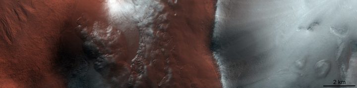
This striking image shows the Argyre impact basin, nearly 500 miles long, located in the southern highlands of Mars. The image was captured on April 28, 2020, when the snow was starting to melt in the Martian spring. The two sides of the image look so different because the slopes of the basin receive different amounts of solar radiation.
“The frost-covered ridge is facing the pole, therefore receiving less solar radiation than the neighboring equator-facing slope,” ESA explained in a post. “On Mars, incoming solar radiation transforms the ice into water vapour directly without melting it first into water in a process called sublimation. Since the north-facing slope (on the left) has had a longer exposure to solar radiation, its ice has sublimated more quickly.”
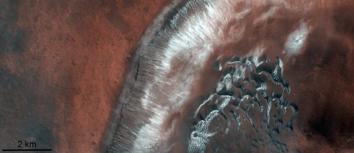
This image was taken nearby in another area of the Argyre quadrangle called the Green Crater on 27 April, 2020. On the right of the image is a dark dune field, while red soil covered in ice is visible on the left of the image.
Another image of a different crater, the Antoniadi impact crater, was captured roughly one month earlier on March 25, 2020. This crater is rather smaller than the Argyre crater, measuring in at around 250 miles long, and is located in the northern hemisphere of the planet. The image has been colorized to show the different type of rocks which are visible on the floor of the crater.
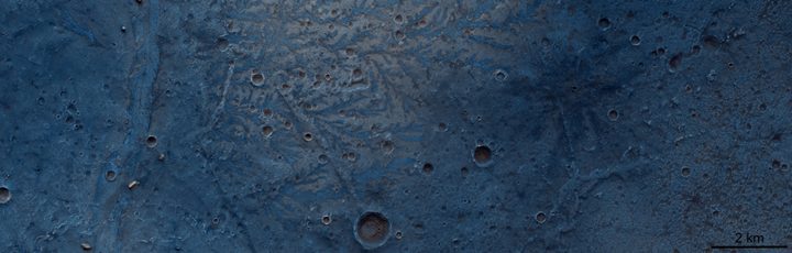
This image is of particular interest as it shows evidence that there was once water on the Martian surface. “In the center of the image are dendritic structures which look like the veins on oak leaves,” ESA says.
“These structures, evidence of ancient river networks in this region, protrude from the surface, unlike channels, which are usually sunken in the surface. This is because the channels were filled with harder material — possibly lava — and over time the softer rocks surrounding these branching channels have been eroded, leaving an inverted imprint of this ancient river system.”
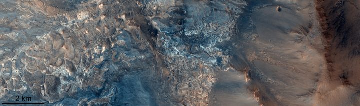
This image shows not a crater but a canyon, the Ius Chasma canyon in the Valles Marines system. This enormous crater system is located in the southern hemisphere near to the equator and stretches for over 600 miles, going as deep as five miles down. ESA points out this makes it twice as long and four times as deep as the Grand Canyon here on Earth.
The beautiful colors of this image represent different types of rock, including salts which remain after the evaporation of an ancient lake.


