
It’s hard to believe Google Maps is turning 15 years old. Through that span, we’ve witnessed its humble beginning on the desktop, eventually evolving to mobile, where it became became the dominant player in navigation. It wasn’t long ago that everyone relied on dedicated in-car GPS units for navigation or, in a pinch, printed out directions on paper (the horror!).
GPS navigation rose, then fell
October 28, 2009 is the day Google Maps changed the world. Throughout the early and mid-2000s, portable GPS navigation units were a staple in cars, providing drivers precise turn-by-turn navigation they could glance at while driving.
A total 33.9 million GPS navigation units were sold during the 2007 holiday season, triple the 11.9 million figure sold over the same period in 2006. Even more telling, the adoption rate was as high as 10 percent among U.S. drivers in 2007, and an even higher 20 percent for Europeans. Garmin, the market leader at the time, reported strong revenue growth each year from 2005 to 2008, reaching record revenue of $3.34 billion in 2008.
GPS navigation changed driving habits, and the companies selling GPS navigation units were reaping the rewards. No longer were drivers forced to make a pit stop to ask for directions, or miss a turn because they failed to anticipate the proper distance to an exit. You punch in the destination, then off you go.
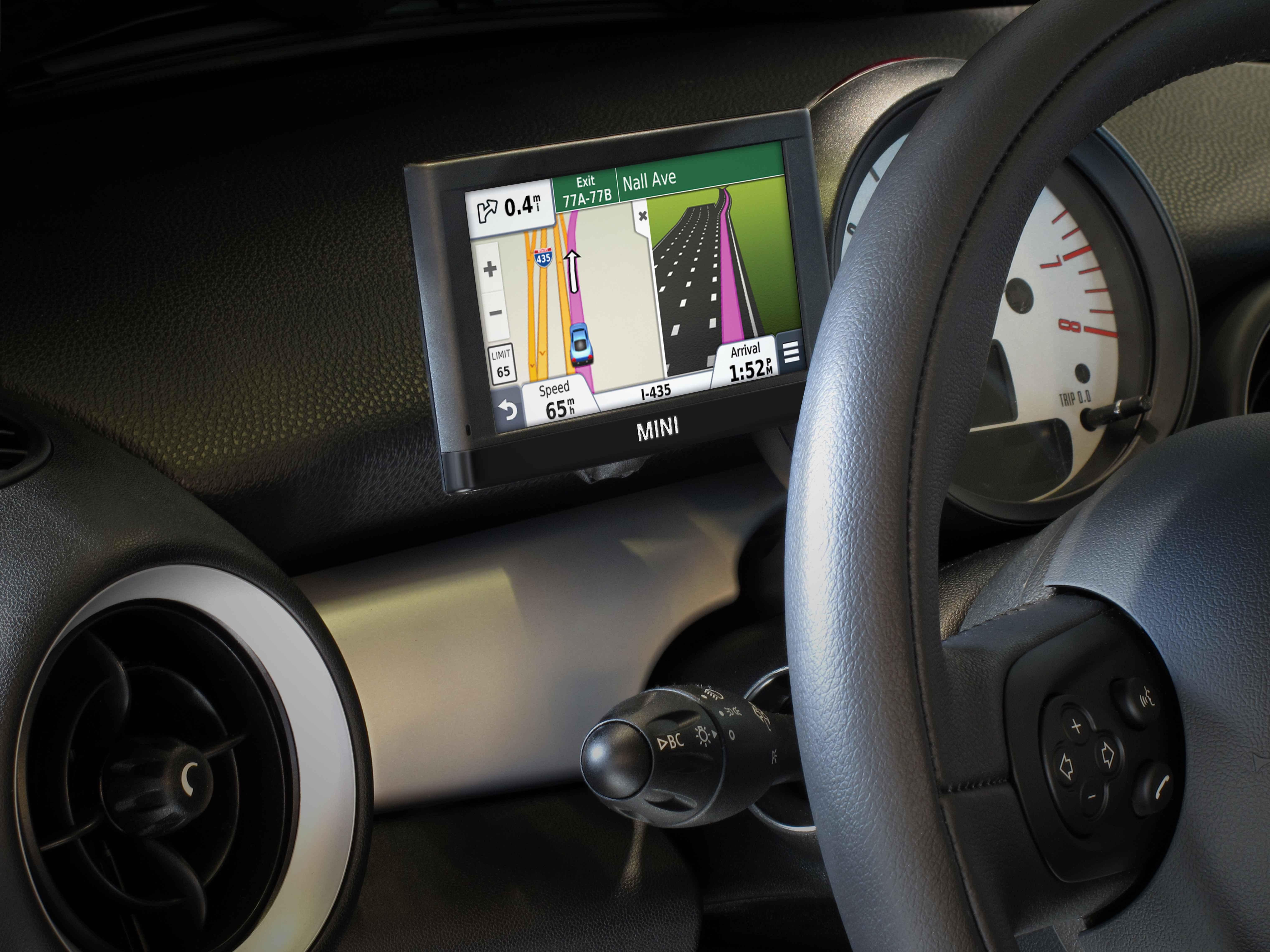
Though expensive at their debut, GPS navigation systems saw prices plummet within years, putting them within reach for most drivers. The popularity of GPS navigation spiked and established companies like TomTom, Garmin, and Magellan as household names.
Then Google launched Google Maps Navigation for Android 2.0.
It wasn’t the announcement of navigation for Google Maps that signaled the decline for GPS navigation companies. Its early incarnation was only on par with what dedicated GPS navigation could do, and not everyone had a smartphone.
The real threat was Google’s price. Free. In contrast, prices for standalone GPS navigation units fell to below $200 in 2007. This spelled the trouble for GPS navigation companies.
That was the beginning of a storm that would sweep away the leaders in GPS. Smartphone sales accelerated year after year starting in 2007, more than doubling between 2007 and 2010. More drivers had access to free navigation with each passing year.
Wireless carriers were collateral damage
The damage extended beyond TomTom and Garmin. Wireless carriers used their own branded, voice assisted navigation services as another revenue stream. These included add-on services like VZ Navigator, Sprint Navigation, and AT&T Navigator.
Strangely enough, these services weren’t only accessible on smartphones, but also on feature and ‘dumb’ phones sold throughout the mid and late 2000s. They were typically preloaded and offered users a free trial. Telenav powered these services, providing on-screen turn-by-turn directions similar to standalone GPS navigation.
These services were priced around $10 per month, which was billed by carriers directly to customers. Over time, however, these add-on navigation services diminished as customers began migrating to smartphones with Google Maps.
Surprisingly, you can still sign up for VZ Navigator and AT&T Navigator today for $5 or $10, respectively. Why? Services like these remain the only way to access turn-by-turn navigation on a smartphone.
One device to rule them all
Free turn-by-turn navigation was a revolutionary feature for Google Maps, but it wouldn’t work without quality smartphones capable of handling the app. Some credit should go to Motorola’s Droid, a key device in Android’s history with 1.05 million units sold through the first 74 days of its release — more than the original iPhone’s tally of one million units.
It remains the smartphone that popularized Google’s Android OS to the masses, thanks in part to the popular “Droid does” ads from Verizon Wireless. Google Maps Navigation rolled out alongside the Motorola Droid’s launch, and was a marquee feature that helped differentiate it from other smartphones at the time.
Now, instead of having to buy two devices, you could purchase a smartphone to have true voice guided navigation. This was a game changer that altered the course of an established industry, forcing companies to branch out to other product categories.
Take a look at how Garmin entered the fitness and wearable market in 2015. Once known for its GPS navigation units, Garmin is now a fitness wearable company. It’s a stark reminder how Google Maps changed the way people navigate.
Google has added many new features to Google Maps since then, such as Live View the ability to download maps for offline view. Yet the moment Google shouted to the world its turn-by-turn service would be free is the moment that changed history. Today, a world without navigation in your pocket seems unfathomable — yet that was reality just 15 years ago.

